Tax account numbers in Anne Arundel County, Maryland, page 169
1 2 3 4 5 6 7 8 9 10 11 12 13 14 15 16 17 18 19 20 21 22 23 24 25 26 27 28 29 30 31 32 33 34 35 36 37 38 39 40 41 42 43 44 45 46 47 48 49 50 51 52 53 54 55 56 57 58 59 60 61 62 63 64 65 66 67 68 69 70 71 72 73 74 75 76 77 78 79 80 81 82 83 84 85 86 87 88 89 90 91 92 93 94 95 96 97 98 99 100 101 102 103 104 105 106 107 108 109 110 111 112 113 114 115 116 117 118 119 120 121 122 123 124 125 126 127 128 129 130 131 132 133 134 135 136 137 138 139 140 141 142 143 144 145 146 147 148 149 150 151 152 153 154 155 156 157 158 159 160 161 162 163 164 165 166 167 168 169 170 171 172 173 174 175 176 177 178 179 180 181 182 183 184 185 186 187 188 189 190 191 192 193 194 195 196 197 198 199 200 201 202 203 204 205 206 207 208 209 210 211 212 213 214 215 216 217 218 219 220 221 222 223 224 225 226
| Address | Map, grid, parcel | Use | Assessed |
|---|---|---|---|
| 1303 Saint Pauls Way | Map 38 Grid 17 Parcel 337 · Lot 10 | Residential | $1,659,200 |
| 1304 Saint Pauls Way | Map 38 Grid 17 Parcel 337 · Lot 14 | Residential | $2,683,300 |
| 1305 Saint Pauls Way | Map 38 Grid 17 Parcel 337 · Lot 9 | Residential | $2,025,800 |
| 1306 Saint Pauls Way | Map 38 Grid 17 Parcel 337 · Lot 18 | Residential | $2,009,800 |
| 1307 Saint Pauls Way | Map 38 Grid 17 Parcel 337 · Lot 8 | Residential | $1,436,300 |
| 1308 Saint Pauls Way | Map 38 Grid 17 Parcel 337 · Lot 15 | Residential | $949,300 |
| 1309 Saint Pauls Way | Map 38 Grid 17 Parcel 337 · Lot 7 | Residential | $1,556,100 |
| 1310 Saint Pauls Way | Map 38 Grid 17 Parcel 337 · Lot 16 | Residential | $3,796,500 |
| 1311 Saint Pauls Way | Map 38 Grid 17 Parcel 337 · Lot 6 | Residential | $1,574,100 |
| 6420 Saint Philips Rd | Map 4 Grid 10 Parcel 1020 · Lot 53 | Residential | $506,300 |
| 6421 Saint Philips Rd | Map 4 Grid 10 Parcel 1020 · Lot 78 | Residential | $485,900 |
| 6422 Saint Philips Rd | Map 4 Grid 10 Parcel 1020 · Lot 54 | Residential | $410,900 |
| 6423 Saint Philips Rd | Map 4 Grid 10 Parcel 1020 · Lot 77 | Residential | $450,700 |
| 6424 Saint Philips Rd | Map 4 Grid 10 Parcel 1020 · Lot 55 | Residential | $357,200 |
| 6425 Saint Philips Rd | Map 4 Grid 10 Parcel 1020 · Lot 76 | Residential | $491,000 |
| 6426 Saint Philips Rd | Map 4 Grid 10 Parcel 1020 · Lot 56 | Residential | $441,400 |
| 6427 Saint Philips Rd | Map 4 Grid 10 Parcel 1020 · Lot 75 | Residential | $456,300 |
| 6428 Saint Philips Rd | Map 4 Grid 10 Parcel 1020 · Lot 57 | Residential | $492,700 |
| 6429 Saint Philips Rd | Map 4 Grid 10 Parcel 1020 · Lot 74 | Residential | $512,500 |
| 6430 Saint Philips Rd | Map 4 Grid 10 Parcel 1020 · Lot 58 | Residential | $469,200 |
| 6431 Saint Philips Rd | Map 4 Grid 10 Parcel 1020 · Lot 73 | Residential | $486,400 |
| 6432 Saint Philips Rd | Map 4 Grid 10 Parcel 1020 · Lot 59 | Residential | $483,800 |
| 6433 Saint Philips Rd | Map 4 Grid 10 Parcel 1020 · Lot 72 | Residential | $486,100 |
| 6434 Saint Philips Rd | Map 4 Grid 10 Parcel 1020 · Lot 60 | Residential | $384,400 |
| 6435 Saint Philips Rd | Map 4 Grid 10 Parcel 1020 · Lot 71 | Residential | $446,000 |
| 6438 Saint Philips Rd | Map 4 Grid 10 Parcel 1020 · Lot 61 | Residential | $424,700 |
| 6439 Saint Philips Rd | Map 4 Grid 10 Parcel 1020 · Lot 70 | Residential | $374,000 |
| 6440 Saint Philips Rd | Map 4 Grid 10 Parcel 1020 · Lot 62 | Residential | $397,200 |
| 6441 Saint Philips Rd | Map 4 Grid 10 Parcel 1020 · Lot 69 | Residential | $351,100 |
| 6443 Saint Philips Rd | Map 4 Grid 10 Parcel 1020 · Lot 68 | Residential | $462,300 |
| 6445 Saint Philips Rd | Map 4 Grid 10 Parcel 1020 · Lot 67 | Residential | $449,500 |
| 6447 Saint Philips Rd | Map 4 Grid 10 Parcel 1020 · Lot 66 | Residential | $446,000 |
| 6449 Saint Philips Rd | Map 4 Grid 10 Parcel 1020 · Lot 65 | Residential | $474,900 |
| 6451 Saint Philips Rd | Map 4 Grid 10 Parcel 1020 · Lot 64 | Residential | $524,700 |
| 6453 Saint Philips Rd | Map 4 Grid 10 Parcel 1020 · Lot 63 | Residential | $385,000 |
| 6454 Saint Philips Rd | Map 4 Grid 10 Parcel 1020 · Lot 43A | Residential | $430,800 |
| 933 Saint Stephens Church Rd | Map 37 Grid 8 Parcel 141 · Lot 5 | Exempt | $761,000 |
| 939 Saint Stephens Church Rd | Map 37 Grid 8 Parcel 141 · Lot 6 | Residential | $693,200 |
| 943 Saint Stephens Church Rd | Map 37 Grid 8 Parcel 141 · Lot 6A | Residential | $861,100 |
| 948 Saint Stephens Church Rd | Map 37 Grid 9 Parcel 70 · Lot 1 | Residential | $696,800 |
| 949 Saint Stephens Church Rd | Map 37 Grid 8 Parcel 141 · Lot 7 | Agricultural | $806,100 |
| 957 Saint Stephens Church Rd | Map 37 Grid 9 Parcel 290 · Lot 2 | Residential | $1,130,600 |
| 959 Saint Stephens Church Rd | Map 37 Grid 9 Parcel 290 · Lot 3 | Residential | $1,670,400 |
| 965 Saint Stephens Church Rd | Map 37 Grid 9 Parcel 290 · Lot 1 | Residential | $1,522,000 |
| 969 Saint Stephens Church Rd | Map 37 Grid 9 Parcel 209 · Lot B | Residential | $535,800 |
| 973 Saint Stephens Church Rd | Map 37 Grid 9 Parcel 202 · Lot A | Residential | $684,500 |
| 977 Saint Stephens Church Rd | Map 37 Grid 9 Parcel 249 · Lot 1 | Residential | $733,800 |
| 985 Saint Stephens Church Rd | Map 37 Grid 9 Parcel 119 | Residential | $3,364,300 |
| 1020 Saint Stephens Church Rd | Map 37 Grid 9 Parcel 323 · Lot 2 | Residential | $565,900 |
| 1024 Saint Stephens Church Rd | Map 37 Grid 9 Parcel 70 · Lot 1 | Residential | $779,800 |
| 1028 Saint Stephens Church Rd | Map 37 Grid 9 Parcel 70 · Lot 2 | Residential | $789,000 |
| 1034 Saint Stephens Church Rd | Map 37 Grid 9 Parcel 220 | Residential | $598,900 |
| 1035 Saint Stephens Church Rd | Map 37 Grid 9 Parcel 156 · Lot C | Residential | $841,400 |
| 1047 Saint Stephens Church Rd | Map 37 Grid 9 Parcel 298 · Lot A | Agricultural | $480,400 |
| 1048 Saint Stephens Church Rd | Map 37 Grid 15 Parcel 72 · Lot 2 | Residential | $602,100 |
| 1052 Saint Stephens Church Rd | Map 37 Grid 15 Parcel 301 · Lot 1 | Residential | $660,500 |
| 1056 Saint Stephens Church Rd | Map 37 Grid 15 Parcel 301 · Lot 3 | Residential | $615,900 |
| 1059 Saint Stephens Church Rd | Map 37 Grid 16 Parcel 302 · Lot B | Agricultural | $2,500 |
| 1059 Saint Stephens Church Rd | Map 37 Grid 15 Parcel 306 · Lot B | Agricultural | $594,300 |
| 1060 Saint Stephens Church Rd | Map 37 Grid 15 Parcel 301 · Lot 2 | Residential | $675,800 |
| 1073 Saint Stephens Church Rd | Map 37 Grid 15 Parcel 224 | Residential | $1,123,400 |
| 1075 Saint Stephens Church Rd | Map 37 Grid 16 Parcel 304 · Lot C | Agricultural | $53,200 |
| 1075 Saint Stephens Church Rd | Map 37 Grid 16 Parcel 304 · Lot C | Residential | $737,600 |
| 1101 Saint Stephens Church Rd | Map 37 Grid 16 Parcel 303 | Agricultural | $375,100 |
| 1103 Saint Stephens Church Rd | Map 37 Grid 16 Parcel 146 | Exempt | $578,800 |
| 1110 Saint Stephens Church Rd | Map 37 Grid 15 Parcel 101 | Exempt Commercial | $854,500 |
| 1112 Saint Stephens Church Rd | Map 37 Grid 15 Parcel 100 | Exempt | $500,600 |
| 1137 Saint Stephens Church Rd | Map 37 Grid 16 Parcel 240 · Lot A | Residential | $698,300 |
| 1139 Saint Stephens Church Rd | Map 37 Grid 16 Parcel 240 · Lot B | Residential | $581,200 |
| 1145 Saint Stephens Church Rd | Map 37 Grid 16 Parcel 90 | Residential | $547,700 |
| 1147 Saint Stephens Church Rd | Map 37 Grid 22 Parcel 197 | Residential | $513,700 |
| 1149 Saint Stephens Church Rd | Map 37 Grid 16 Parcel 210 | Residential | $520,900 |
| 1153 Saint Stephens Church Rd | Map 37 Grid 16 Parcel 170 | Residential | $396,200 |
| 1159 Saint Stephens Church Rd | Map 37 Grid 22 Parcel 335 | Agricultural | $712,000 |
| 1160 Saint Stephens Church Rd | Map 37 Grid 22 Parcel 171 | Residential | $712,700 |
| 1164 Saint Stephens Church Rd | Map 37 Grid 22 Parcel 139 · Lot B | Residential | $408,900 |
| 1170 Saint Stephens Church Rd | Map 37 Grid 22 Parcel 83 | Residential | $621,000 |
| 1175 Saint Stephens Church Rd | Map 37 Grid 22 Parcel 335 · Lot 2 | Agricultural | $1,400 |
| 1180 Saint Stephens Church Rd | Map 37 Grid 22 Parcel 335 | Agricultural | $577,900 |
| 1190 Saint Stephens Church Rd | Map 37 Grid 22 Parcel 140 · Lot C | Residential | $517,300 |
| 1191 Saint Stephens Church Rd | Map 37 Grid 22 Parcel 335 · Lot 1 | Agricultural | $510,900 |
| 1211 Saint Stephens Church Rd | Map 37 Grid 23 Parcel 261 | Agricultural | $917,600 |
| 1213 Saint Stephens Church Rd | Map 37 Grid 23 Parcel 257 | Residential | $650,600 |
| 1213 Saint Stephens Church Rd | Map 37 Grid 23 Parcel 326 | Agricultural | $26,200 |
| 1228 Saint Stephens Church Rd | Map 37 Grid 22 Parcel 190 · Lot 1 | Agricultural | $291,200 |
| 1236 Saint Stephens Church Rd | Map 37 Grid 22 Parcel 190 · Lot 2 | Agricultural | $1,209,500 |
| 1237 Saint Stephens Church Rd | Map 37 Grid 22 Parcel 153 | Agricultural | $455,200 |
| 1242 Saint Stephens Church Rd | Map 37 Grid 23 Parcel 327 | Agricultural | $2,900 |
| 1245 Saint Stephens Church Rd | Map 37 Grid 23 Parcel 327 · Lot 3 | Residential | $639,200 |
| 1251 Saint Stephens Church Rd | Map 37 Grid 23 Parcel 327 · Lot 1 | Agricultural | $494,500 |
| 1255 Saint Stephens Church Rd | Map 37 Grid 23 Parcel 327 · Lot 2 | Residential | $684,500 |
| 1271 Saint Stephens Church Rd | Map 37 Grid 23 Parcel 189 | Agricultural | $658,200 |
| 1271 Saint Stephens Church Rd | Map 30 Grid 21 Parcel 350 | Commercial | $185,200 |
| 1282 Saint Stephens Church Rd | Map 43 Grid 5 Parcel 186 | Agricultural | $848,200 |
| 1292 Saint Stephens Church Rd | Map 43 Grid 5 Parcel 185 · Lot 1R | Agricultural | $816,600 |
| 1311 Saint Stephens Church Rd | Map 43 Grid 5 Parcel 10 · Lot 5R1 | Residential | $352,500 |
| 1315 Saint Stephens Church Rd | Map 43 Grid 5 Parcel 10 · Lot 4R | Residential | $830,100 |
| 1317 Saint Stephens Church Rd | Map 43 Grid 5 Parcel 10 · Lot 5R3 | Residential | $720,400 |
| 1320 Saint Stephens Church Rd | Map 43 Grid 5 Parcel 294 · Lot 1 | Agricultural | $353,200 |
| 1321 Saint Stephens Church Rd | Map 43 Grid 5 Parcel 10 · Lot 5R2 | Residential | $999,100 |
| 1323 Saint Stephens Church Rd | Map 43 Grid 5 Parcel 206 · Lot 3R1 | Exempt | $748,100 |
| 1326 Saint Stephens Church Rd | Map 43 Grid 5 Parcel 294 · Lot 4B | Agricultural | $862,800 |
| 1327 Saint Stephens Church Rd | Map 43 Grid 5 Parcel 206 · Lot 3R2 | Residential | $870,400 |
| 1330 Saint Stephens Church Rd | Map 43 Grid 5 Parcel 294 · Lot 2 | Agricultural | $490,000 |
| 1331 Saint Stephens Church Rd | Map 43 Grid 5 Parcel 206 · Lot 3R3 | Residential | $734,600 |
| 1333 Saint Stephens Church Rd | Map 43 Grid 5 Parcel 196 | Residential | $567,200 |
| 1340 Saint Stephens Church Rd | Map 43 Grid 5 Parcel 294 · Lot 3A | Residential | $453,600 |
| 1346 Saint Stephens Church Rd | Map 43 Grid 10 Parcel 4 | Residential | $496,200 |
| 1347 Saint Stephens Church Rd | Map 43 Grid 5 Parcel 10 · Lot 1AR | Residential | $411,600 |
| 1348 Saint Stephens Church Rd | Map 43 Grid 10 Parcel 41 | Agricultural | $67,300 |
| 1349 Saint Stephens Church Rd | Map 43 Grid 5 Parcel 10 · Lot 1BR | Residential | $85,700 |
| 1350 Saint Stephens Church Rd | Map 43 Grid 5 Parcel 102 | Residential | $470,900 |
| 1356 Saint Stephens Church Rd | Map 43 Grid 5 Parcel 294 · Lot 4R | Agricultural | $165,000 |
| 1358 Saint Stephens Church Rd | Map 43 Grid 10 Parcel 127 | Residential | $1,258,600 |
| 1360 Saint Stephens Church Rd | Map 43 Grid 5 Parcel 294 · Lot 4A | Residential | $668,200 |
| 1366 Saint Stephens Church Rd | Map 43 Grid 11 Parcel 43 · Lot 2 | Residential | $1,140,900 |
| 1372 Saint Stephens Church Rd | Map 43 Grid 11 Parcel 43 · Lot 13 | Exempt | $1,258,200 |
| 1373 Saint Stephens Church Rd | Map 43 Grid 6 Parcel 13 | Agricultural | $512,900 |
| 1407 Saint Stephens Church Rd | Map 43 Grid 12 Parcel 293 | Exempt | $313,600 |
| 1416 Saint Stephens Church Rd | Map 43 Grid 11 Parcel 253 · Lot 9 | Residential | $664,200 |
| 1421 Saint Stephens Church Rd | Map 43 Grid 12 Parcel 56 | Exempt Commercial | $345,600 |
| 1423 Saint Stephens Church Rd | Map 43 Grid 12 Parcel 299 · Lot 2R | Residential | $1,198,000 |
| 1427 Saint Stephens Church Rd | Map 43 Grid 12 Parcel 299 · Lot 1RR | Residential | $982,100 |
| 1434 Saint Stephens Church Rd | Map 43 Grid 11 Parcel 131 · Lot 5 | Residential | $713,900 |
| 1440 Saint Stephens Church Rd | Map 43 Grid 12 Parcel 175 · Lot 1 | Residential | $758,200 |
| 1442 Saint Stephens Church Rd | Map 43 Grid 12 Parcel 175 · Lot 2 | Exempt | $818,900 |
| 1448 Saint Stephens Church Rd | Map 43 Grid 12 Parcel 53 · Lot 2 | Exempt | $879,400 |
| 1450 Saint Stephens Church Rd | Map 43 Grid 12 Parcel 53 · Lot 1 | Residential | $508,500 |
| 1461 Saint Stephens Church Rd | Map 44 Grid 7 Parcel 289 · Lot 7RR | Residential | $1,644,700 |
| 1472 Saint Stephens Church Rd | Map 43 Grid 18 Parcel 301 · Lot 2 | Residential | $604,800 |
| 1476 Saint Stephens Church Rd | Map 43 Grid 18 Parcel 83 | Residential | $481,700 |
| 1478 Saint Stephens Church Rd | Map 43 Grid 18 Parcel 54 | Agricultural | $443,500 |
| 1479 Saint Stephens Church Rd | Map 43 Grid 12 Parcel 178 | Residential | $1,130,400 |
| 1501 Saint Stephens Church Rd | Map 43 Grid 18 Parcel 15 | Residential | $590,200 |
| 1524 Saint Stephens Church Rd | Map 43 Grid 18 Parcel 55 · Lot 2 | Residential | $676,800 |
| 1526 Saint Stephens Church Rd | Map 43 Grid 18 Parcel 55 · Lot PT17 | Residential | $637,000 |
| 1528 Saint Stephens Church Rd | Map 43 Grid 18 Parcel 55 · Lot 1 | Residential | $674,200 |
| 1555 Saint Stephens Church Rd | Map 43 Grid 18 Parcel 172 · Lot 3 | Residential | $374,400 |
| 1521 Saint Stephens Church Rd #OPEN SPACE | Map 43 Grid 18 Parcel 55 · Lot PT17 | Exempt | $282,200 |
| 2005 Saint Stephens Woods Dr | Map 37 Grid 16 Parcel 240 · Lot 1 | Residential | $1,078,300 |
| 2007 Saint Stephens Woods Dr | Map 37 Grid 16 Parcel 240 · Lot 2 | Residential | $985,400 |
| 2008 Saint Stephens Woods Dr | Map 37 Grid 16 Parcel 240 · Lot 4 | Residential | $734,200 |
| 2009 Saint Stephens Woods Dr | Map 37 Grid 16 Parcel 240 · Lot 3 | Residential | $928,100 |
| 2010 Saint Stephens Woods Dr | Map 37 Grid 16 Parcel 240 · Lot 5 | Residential | $1,280,500 |
| 2011 Saint Stephens Woods Dr | Map 37 Grid 16 Parcel 240 · Lot 6 | Residential | $1,670,900 |
| 213 Saint Swithins Ln | Map 45 Grid 5 Parcel 1 · Lot 30 | Residential | $696,100 |
| 214 Saint Swithins Ln | Map 45 Grid 5 Parcel 1 · Lot 32 | Residential | $753,100 |
| 215 Saint Swithins Ln | Map 45 Grid 5 Parcel 1 · Lot 29 | Residential | $848,300 |
| 217 Saint Swithins Ln | Map 45 Grid 5 Parcel 1 · Lot 28 | Residential | $709,400 |
| 1042 Salem Hbr | Map 11 Grid 21 Parcel 123 · Lot 268 | Residential | $295,700 |
| 1044 Salem Hbr | Map 11 Grid 21 Parcel 123 · Lot 267 | Residential | $287,600 |
| 1046 Salem Hbr | Map 11 Grid 21 Parcel 123 · Lot 266 | Residential | $328,700 |
| 1048 Salem Hbr | Map 11 Grid 21 Parcel 123 · Lot 265 | Residential | $275,100 |
| 1050 Salem Hbr | Map 11 Grid 21 Parcel 123 · Lot 264 | Residential | $297,100 |
| 1052 Salem Hbr | Map 11 Grid 21 Parcel 123 · Lot 263 | Residential | $283,400 |
| 1054 Salem Hbr | Map 11 Grid 21 Parcel 123 · Lot 262 | Residential | $289,400 |
| 1056 Salem Hbr | Map 11 Grid 21 Parcel 123 · Lot 261 | Residential | $303,200 |
| 1058 Salem Hbr | Map 11 Grid 21 Parcel 123 · Lot 260 | Residential | $297,100 |
| 1060 Salem Hbr | Map 11 Grid 21 Parcel 123 · Lot 259 | Residential | $278,000 |
| 1062 Salem Hbr | Map 11 Grid 21 Parcel 123 · Lot 258 | Residential | $305,700 |
| 1064 Salem Hbr | Map 11 Grid 21 Parcel 123 · Lot 257 | Residential | $352,100 |
| 1300 Salem Run | Map 37 Grid 17 Parcel 314 · Lot 57R | Residential | $1,050,200 |
| 1301 Salem Run | Map 37 Grid 17 Parcel 314 · Lot 46 | Residential | $988,400 |
| 1302 Salem Run | Map 37 Grid 17 Parcel 314 · Lot 56R | Residential | $987,600 |
| 1304 Salem Run | Map 37 Grid 17 Parcel 314 · Lot 55 | Residential | $1,107,400 |
| 1305 Salem Run | Map 37 Grid 17 Parcel 314 · Lot 47 | Residential | $1,102,700 |
| 1306 Salem Run | Map 37 Grid 17 Parcel 314 · Lot 54 | Residential | $1,228,200 |
| 1308 Salem Run | Map 37 Grid 17 Parcel 314 · Lot 53 | Residential | $1,135,500 |
| 1309 Salem Run | Map 37 Grid 17 Parcel 314 · Lot 48 | Residential | $955,400 |
| 1310 Salem Run | Map 37 Grid 17 Parcel 314 · Lot 52 | Residential | $1,158,300 |
| 1312 Salem Run | Map 37 Grid 17 Parcel 314 · Lot 51R | Residential | $1,091,700 |
| 1313 Salem Run | Map 37 Grid 17 Parcel 314 · Lot 49 | Residential | $1,047,200 |
| 1314 Salem Run | Map 37 Grid 17 Parcel 314 · Lot 50R | Residential | $1,412,600 |
| 1902 Salford Ct | Map 43 Grid 8 Parcel 125 · Lot 22 | Residential | $616,700 |
| 1904 Salford Ct | Map 43 Grid 8 Parcel 125 · Lot 21 | Residential | $584,000 |
| 1906 Salford Ct | Map 43 Grid 8 Parcel 125 · Lot 20 | Residential | $558,600 |
| 2619 Salford Dr | Map 43 Grid 8 Parcel 125 · Lot 1 | Residential | $567,200 |
| 2621 Salford Dr | Map 43 Grid 8 Parcel 125 · Lot 2 | Residential | $530,400 |
| 2622 Salford Dr | Map 43 Grid 8 Parcel 125 · Lot 19 | Residential | $578,600 |
| 2623 Salford Dr | Map 43 Grid 8 Parcel 125 · Lot 3 | Residential | $560,800 |
| 2624 Salford Dr | Map 43 Grid 8 Parcel 125 · Lot 18 | Residential | $724,400 |
| 2625 Salford Dr | Map 43 Grid 8 Parcel 125 · Lot 4 | Residential | $595,100 |
| 2626 Salford Dr | Map 43 Grid 8 Parcel 125 · Lot 17 | Residential | $657,200 |
| 2627 Salford Dr | Map 43 Grid 8 Parcel 125 · Lot 5 | Residential | $547,500 |
| 2628 Salford Dr | Map 43 Grid 8 Parcel 125 · Lot 16 | Residential | $719,100 |
| 2630 Salford Dr | Map 43 Grid 8 Parcel 125 · Lot 15 | Residential | $731,500 |
| 2631 Salford Dr | Map 43 Grid 8 Parcel 125 · Lot 6 | Residential | $534,400 |
| 2632 Salford Dr | Map 43 Grid 8 Parcel 125 · Lot 14 | Residential | $524,200 |
| 2633 Salford Dr | Map 43 Grid 8 Parcel 125 · Lot 7 | Residential | $539,500 |
| 2634 Salford Dr | Map 43 Grid 8 Parcel 125 · Lot 13 | Residential | $547,600 |
| 2635 Salford Dr | Map 43 Grid 8 Parcel 125 · Lot 8 | Residential | $539,600 |
| 2636 Salford Dr | Map 43 Grid 8 Parcel 125 · Lot 12 | Residential | $630,700 |
| 2637 Salford Dr | Map 43 Grid 8 Parcel 125 · Lot 9 | Residential | $631,700 |
| 2638 Salford Dr | Map 43 Grid 8 Parcel 125 · Lot 11 | Residential | $590,500 |
| 2639 Salford Dr | Map 43 Grid 8 Parcel 125 · Lot 10 | Residential | $609,400 |
| 8700 Salinas Ct | Map 29 Grid 14 Parcel 394 · Lot 50 | Residential | $407,400 |
| 8702 Salinas Ct | Map 29 Grid 14 Parcel 394 · Lot 48 | Residential | $388,200 |
| 8704 Salinas Ct | Map 29 Grid 14 Parcel 394 · Lot 46 | Residential | $402,100 |
| 8706 Salinas Ct | Map 29 Grid 14 Parcel 394 · Lot 44 | Residential | $399,700 |
| 8708 Salinas Ct | Map 29 Grid 14 Parcel 394 · Lot 42 | Residential | $400,200 |
| 8710 Salinas Ct | Map 29 Grid 14 Parcel 394 · Lot 40 | Residential | $392,900 |
| 8712 Salinas Ct | Map 29 Grid 14 Parcel 394 · Lot 38 | Residential | $419,400 |
| 8714 Salinas Ct | Map 29 Grid 14 Parcel 394 · Lot 36 | Residential | $393,500 |
| 8716 Salinas Ct | Map 29 Grid 14 Parcel 394 · Lot 34 | Residential | $412,100 |
| 8718 Salinas Ct | Map 29 Grid 14 Parcel 394 · Lot 32 | Residential | $413,100 |
| 8720 Salinas Ct | Map 29 Grid 14 Parcel 394 · Lot 30 | Residential | $398,400 |
| 160 Salisbury Rd | Map 56 Grid 13 Parcel 128 · Lot 779 | Commercial | $413,700 |
| 304 Salisbury Rd | Map 56 Grid 13 Parcel 128 · Lot 784 | Residential | $290,100 |
| 310 Salisbury Rd | Map 56 Grid 13 Parcel 128 · Lot 925 | Residential | $308,000 |
| 313 Salisbury Rd | Map 56 Grid 13 Parcel 128 · Lot 913 | Residential | $313,600 |
| 314 Salisbury Rd | Map 56 Grid 13 Parcel 128 · Lot 918 | Residential | $333,500 |
| 318 Salisbury Rd | Map 56 Grid 13 Parcel 128 · Lot 1172 | Residential | $393,500 |
| 320 Salisbury Rd | Map 56 Grid 13 Parcel 128 · Lot 1175 | Residential | $421,600 |
| 321 Salisbury Rd | Map 56 Grid 13 Parcel 128 · Lot 1189 | Residential | $397,200 |
| 322 Salisbury Rd | Map 56 Grid 13 Parcel 128 · Lot 1177 | Residential | $372,800 |
| 323 Salisbury Rd | Map 56 Grid 13 Parcel 128 · Lot 1182 | Residential | $371,000 |
| 324 Salisbury Rd | Map 56 Grid 13 Parcel 128 · Lot 1179 | Residential | $384,200 |
| 329 Salisbury Rd | Map 56 Grid 13 Parcel 127 · Lot 3506 | Residential | $341,300 |
| 330 Salisbury Rd | Map 56 Grid 13 Parcel 127 · Lot 3509 | Residential | $343,200 |
| 331 Salisbury Rd | Map 56 Grid 13 Parcel 127 · Lot 3504 | Residential | $347,300 |
| 332 Salisbury Rd | Map 56 Grid 13 Parcel 127 · Lot 3512 | Residential | $516,700 |
| 333 Salisbury Rd | Map 56 Grid 13 Parcel 127 · Lot 3502 | Residential | $284,900 |
| 335 Salisbury Rd | Map 56 Grid 13 Parcel 127 · Lot 3499 | Residential | $381,100 |
| 400 Salisbury Rd | Map 56 Grid 13 Parcel 127 · Lot 3635 | Residential | $383,600 |
| 402 Salisbury Rd | Map 56 Grid 13 Parcel 127 · Lot 3638 | Residential | $367,000 |
| 404 Salisbury Rd | Map 56 Grid 13 Parcel 127 · Lot 3640 | Residential | $411,000 |
| 408 Salisbury Rd | Map 56 Grid 13 Parcel 127 · Lot 3645 | Residential | $320,000 |
| 410 Salisbury Rd | Map 56 Grid 13 Parcel 127 · Lot 3648 | Residential | $584,600 |
| 413 Salisbury Rd | Map 56 Grid 13 Parcel 127 · Lot 3338 | Residential | $395,500 |
| 414 Salisbury Rd | Map 56 Grid 13 Parcel 127 · Lot 3651 | Residential | $516,900 |
| 415 Salisbury Rd | Map 56 Grid 13 Parcel 127 · Lot 3336 | Residential | $337,100 |
| 423 Salisbury Rd | Map 56 Grid 13 Parcel 127 · Lot 3285 | Residential | $385,300 |
| 424 Salisbury Rd | Map 56 Grid 13 Parcel 127 · Lot 3774 | Residential | $377,400 |
| 425 Salisbury Rd | Map 56 Grid 13 Parcel 127 · Lot 3282 | Residential | $364,600 |
| 426 Salisbury Rd | Map 56 Grid 13 Parcel 127 · Lot 3776 | Residential | $415,900 |
| 430 Salisbury Rd | Map 56 Grid 13 Parcel 127 · Lot 3783R | Residential | $320,000 |
| 432 Salisbury Rd | Map 56 Grid 13 Parcel 127 · Lot 3786 | Residential | $372,500 |
| 433 Salisbury Rd | Map 56 Grid 13 Parcel 127 · Lot 3275 | Residential | $170,000 |
| 434 Salisbury Rd | Map 56 Grid 13 Parcel 127 · Lot 3788 | Residential | $347,500 |
| 1904 Salisbury Rd | Map 56 Grid 13 Parcel 128 · Lot 281 | Commercial | $74,500 |
| 1906 Salisbury Rd | Map 56 Grid 13 Parcel 128 · Lot 284 | Residential | $368,400 |
| 1908 Salisbury Rd | Map 56 Grid 13 Parcel 128 · Lot 287 | Residential | $370,300 |
| 1909 Salisbury Rd | Map 56 Grid 13 Parcel 128 · Lot 242 | Residential | $353,400 |
| 1910 Salisbury Rd | Map 56 Grid 13 Parcel 128 · Lot 290 | Residential | $413,000 |
| 1912 Salisbury Rd | Map 56 Grid 13 Parcel 128 · Lot 293 | Residential | $375,600 |
| 600 Salt Marsh Ln | Map 33 Grid 19 Parcel 241 · Lot 1 | Residential | $22,800 |
| 602 Salt Marsh Ln | Map 33 Grid 19 Parcel 241 · Lot 2 | Residential | $14,400 |
| 604 Salt Marsh Ln | Map 33 Grid 19 Parcel 241 · Lot 3 | Residential | $13,200 |
| 606 Salt Marsh Ln | Map 33 Grid 19 Parcel 241 · Lot 4 | Residential | $13,200 |
| 203 Saltgrass Dr | Map 10 Grid 15 Parcel 369 · Lot 10 | Residential | $503,300 |
| 204 Saltgrass Dr | Map 10 Grid 15 Parcel 369 · Lot 11 | Residential | $496,800 |
| 205 Saltgrass Dr | Map 10 Grid 15 Parcel 369 · Lot 9 | Residential | $530,400 |
| 206 Saltgrass Dr | Map 10 Grid 15 Parcel 369 · Lot 12 | Residential | $546,900 |
| 207 Saltgrass Dr | Map 10 Grid 15 Parcel 369 · Lot 8 | Residential | $606,100 |
| 208 Saltgrass Dr | Map 10 Grid 15 Parcel 369 · Lot 13 | Residential | $578,000 |
| 209 Saltgrass Dr | Map 10 Grid 15 Parcel 369 · Lot 7 | Residential | $441,400 |
| 210 Saltgrass Dr | Map 10 Grid 15 Parcel 369 · Lot 14 | Residential | $616,300 |
| 211 Saltgrass Dr | Map 10 Grid 15 Parcel 369 · Lot 6 | Residential | $600,900 |
| 212 Saltgrass Dr | Map 10 Grid 15 Parcel 369 · Lot 15 | Residential | $582,200 |
| 213 Saltgrass Dr | Map 10 Grid 15 Parcel 369 | Residential | $456,000 |
| 214 Saltgrass Dr | Map 10 Grid 15 Parcel 369 · Lot 16 | Residential | $561,900 |
| 215 Saltgrass Dr | Map 10 Grid 15 Parcel 369 · Lot 4 | Residential | $456,300 |
| 216 Saltgrass Dr | Map 10 Grid 15 Parcel 369 · Lot 17 | Residential | $643,600 |
| 217 Saltgrass Dr | Map 10 Grid 15 Parcel 369 · Lot 3 | Residential | $449,700 |
| 219 Saltgrass Dr | Map 10 Grid 15 Parcel 369 · Lot 2 | Residential | $614,000 |
| 221 Saltgrass Dr | Map 10 Grid 15 Parcel 369 · Lot 1 | Residential | $488,700 |
| 223 Saltgrass Dr | Map 10 Grid 15 Parcel 369 · Lot 87 | Residential Condominium | $700,300 |
| 225 Saltgrass Dr | Map 10 Grid 15 Parcel 369 · Lot 86 | Residential | $623,100 |
| 226 Saltgrass Dr | Map 10 Grid 15 Parcel 369 · Lot 18 | Residential | $538,700 |
| 227 Saltgrass Dr | Map 10 Grid 15 Parcel 369 · Lot 85 | Residential | $547,200 |
| 228 Saltgrass Dr | Map 10 Grid 15 Parcel 369 · Lot 19 | Residential | $657,500 |
| 229 Saltgrass Dr | Map 10 Grid 15 Parcel 369 · Lot 84 | Residential | $553,500 |
| 231 Saltgrass Dr | Map 10 Grid 15 Parcel 369 · Lot 83 | Residential | $587,800 |
| 232 Saltgrass Dr | Map 10 Grid 15 Parcel 369 · Lot 20 | Residential | $635,300 |
| 234 Saltgrass Dr | Map 10 Grid 15 Parcel 369 · Lot 21 | Residential | $801,700 |
| 235 Saltgrass Dr | Map 10 Grid 15 Parcel 369 · Lot 82 | Residential | $722,600 |
| 236 Saltgrass Dr | Map 10 Grid 15 Parcel 369 · Lot 22 | Residential | $700,600 |
| 237 Saltgrass Dr | Map 10 Grid 15 Parcel 369 · Lot 81 | Residential | $500,300 |
| 238 Saltgrass Dr | Map 10 Grid 15 Parcel 369 · Lot 23 | Residential | $600,100 |
| 239 Saltgrass Dr | Map 10 Grid 15 Parcel 369 · Lot 80 | Residential | $512,400 |
| 240 Saltgrass Dr | Map 10 Grid 15 Parcel 369 · Lot 24 | Residential | $623,600 |
| 241 Saltgrass Dr | Map 10 Grid 15 Parcel 369 · Lot 79 | Exempt | $633,600 |
| 242 Saltgrass Dr | Map 10 Grid 15 Parcel 369 · Lot 25 | Residential | $749,500 |
| 243 Saltgrass Dr | Map 10 Grid 15 Parcel 369 · Lot 78 | Residential | $707,400 |
| 244 Saltgrass Dr | Map 10 Grid 15 Parcel 369 · Lot 26 | Residential | $540,100 |
| 248 Saltgrass Dr | Map 10 Grid 15 Parcel 369 · Lot 27 | Residential | $616,600 |
| 250 Saltgrass Dr | Map 10 Grid 15 Parcel 369 · Lot 28 | Residential | $640,700 |
| 252 Saltgrass Dr | Map 10 Grid 15 Parcel 369 · Lot 29 | Residential | $755,700 |
| 253 Saltgrass Dr | Map 10 Grid 15 Parcel 369 · Lot 77 | Exempt | $632,900 |
| 254 Saltgrass Dr | Map 10 Grid 15 Parcel 369 · Lot 30 | Residential | $641,200 |
| 255 Saltgrass Dr | Map 10 Grid 15 Parcel 369 · Lot 76 | Residential Condominium | $610,000 |
| 256 Saltgrass Dr | Map 10 Grid 15 Parcel 369 · Lot 31 | Residential | $671,700 |
| 257 Saltgrass Dr | Map 10 Grid 15 Parcel 369 · Lot 75 | Residential | $651,900 |
| 258 Saltgrass Dr | Map 10 Grid 15 Parcel 369 · Lot 32 | Residential | $663,300 |
| 259 Saltgrass Dr | Map 10 Grid 15 Parcel 369 · Lot 74 | Residential | $508,500 |
| 260 Saltgrass Dr | Map 10 Grid 15 Parcel 369 · Lot 33 | Residential | $590,300 |
| 261 Saltgrass Dr | Map 10 Grid 15 Parcel 369 · Lot 73 | Residential | $699,700 |
| 262 Saltgrass Dr | Map 10 Grid 15 Parcel 369 · Lot 34 | Residential | $529,600 |
| 264 Saltgrass Dr | Map 10 Grid 15 Parcel 369 · Lot 35 | Residential | $647,300 |
| 265 Saltgrass Dr | Map 10 Grid 15 Parcel 369 · Lot 72 | Residential | $666,100 |
| 266 Saltgrass Dr | Map 10 Grid 15 Parcel 369 · Lot 36 | Residential | $680,700 |
| 267 Saltgrass Dr | Map 10 Grid 15 Parcel 369 · Lot 71 | Residential | $663,200 |
| 268 Saltgrass Dr | Map 10 Grid 15 Parcel 369 · Lot 37 | Residential | $717,200 |
| 269 Saltgrass Dr | Map 10 Grid 15 Parcel 369 · Lot 70 | Residential | $533,100 |
| 270 Saltgrass Dr | Map 10 Grid 15 Parcel 369 · Lot 38 | Residential | $612,200 |
| 271 Saltgrass Dr | Map 10 Grid 15 Parcel 369 · Lot 69 | Residential | $462,100 |
| 272 Saltgrass Dr | Map 10 Grid 15 Parcel 369 · Lot 39 | Residential | $712,100 |
| 273 Saltgrass Dr | Map 10 Grid 15 Parcel 369 · Lot 68 | Exempt | $688,700 |
| 274 Saltgrass Dr | Map 10 Grid 15 Parcel 369 · Lot 40 | Residential | $633,500 |
| 276 Saltgrass Dr | Map 10 Grid 15 Parcel 369 · Lot 41 | Residential | $624,100 |
| 278 Saltgrass Dr | Map 10 Grid 15 Parcel 369 · Lot 42 | Residential | $631,600 |
| 284 Saltgrass Dr | Map 10 Grid 15 Parcel 369 · Lot 43 | Residential | $695,400 |
| 286 Saltgrass Dr | Map 10 Grid 15 Parcel 369 · Lot 44 | Residential | $461,300 |
| 288 Saltgrass Dr | Map 10 Grid 15 Parcel 369 · Lot 45 | Exempt | $682,000 |
| 243 Saltgrass Dr #BOAT SLIP 1 | Map 10 Grid 15 Parcel 369 | Residential Condominium | $2,000 |
| 261 Saltgrass Dr #BOAT SLIP 12 | Map 10 Grid 15 Parcel 369 | Residential Condominium | $2,000 |
| 208 Saltgrass Dr #BOAT SLIP 16 | Map 10 Grid 15 Parcel 369 | Residential Condominium | $2,000 |
| 228 Saltgrass Dr #BOAT SLIP 18 | Map 10 Grid 15 Parcel 369 | Residential Condominium | $6,000 |
| 211 Saltgrass Dr #BOAT SLIP 27 | Map 10 Grid 15 Parcel 369 | Residential Condominium | $6,000 |
| 205 Saltgrass Dr #BOAT SLIP 29 | Map 10 Grid 15 Parcel 369 | Residential Condominium | $6,000 |
| 244 Saltgrass Dr #BOAT SLIP 32 | Map 10 Grid 15 Parcel 369 | Residential Condominium | $6,000 |
| 212 Saltgrass Dr #BOAT SLIP 33 | Map 10 Grid 15 Parcel 369 | Residential Condominium | $6,000 |
| 214 Saltgrass Dr #BOAT SLIP 39 | Map 10 Grid 15 Parcel 369 | Residential Condominium | $6,000 |
| 252 Saltgrass Dr #BOAT SLIP 5 | Map 10 Grid 15 Parcel 369 | Residential Condominium | $2,000 |
| 491 Saltoun Ave | Map 29 Grid 11 Parcel 323 · Block J Lot 1 | Residential | $348,400 |
| 492 Saltoun Ave | Map 29 Grid 11 Parcel 323 · Block L Lot 6 | Residential | $347,100 |
| 493 Saltoun Ave | Map 29 Grid 11 Parcel 323 · Block J Lot 11 | Residential | $371,900 |
| 494 Saltoun Ave | Map 29 Grid 11 Parcel 323 · Block L Lot 5 | Residential | $409,700 |
| 495 Saltoun Ave | Map 29 Grid 11 Parcel 323 · Block J Lot 10 | Residential | $330,900 |
| 496 Saltoun Ave | Map 29 Grid 11 Parcel 323 · Block L Lot 4 | Residential | $469,600 |
| 497 Saltoun Ave | Map 29 Grid 11 Parcel 323 · Block J Lot 9 | Residential | $363,100 |
| 499 Saltoun Ave | Map 29 Grid 11 Parcel 323 · Block J Lot 8 | Residential | $370,800 |
| 500 Saltoun Ave | Map 29 Grid 11 Parcel 323 · Block M Lot 11 | Residential | $350,600 |
| 501 Saltoun Ave | Map 29 Grid 11 Parcel 323 · Block H Lot 1 | Residential | $378,900 |
| 502 Saltoun Ave | Map 29 Grid 11 Parcel 323 · Block M Lot 12 | Residential | $415,600 |
| 503 Saltoun Ave | Map 29 Grid 11 Parcel 323 · Block H Lot 17 | Residential | $424,200 |
| 504 Saltoun Ave | Map 29 Grid 11 Parcel 323 · Block M Lot 13 | Residential | $324,400 |
| 505 Saltoun Ave | Map 29 Grid 11 Parcel 323 · Block H Lot 16 | Residential | $407,600 |
| 506 Saltoun Ave | Map 29 Grid 11 Parcel 323 · Block M Lot 14 | Residential | $328,300 |
| 507 Saltoun Ave | Map 29 Grid 11 Parcel 323 · Block H Lot 15 | Residential | $404,700 |
| 508 Saltoun Ave | Map 29 Grid 11 Parcel 323 · Block M Lot 15 | Residential | $452,500 |
| 509 Saltoun Ave | Map 29 Grid 11 Parcel 323 · Block H Lot 14 | Residential | $423,300 |
| 510 Saltoun Ave | Map 29 Grid 11 Parcel 323 · Block M Lot 1 | Residential | $338,200 |
| 511 Saltoun Ave | Map 29 Grid 11 Parcel 323 · Block H Lot 13 | Residential | $465,700 |
| 513 Saltoun Ave | Map 29 Grid 11 Parcel 323 · Block H Lot 12 | Residential | $316,500 |
| 516 Saltoun Ave | Map 29 Grid 11 Parcel 323 · Block N Lot 10 | Residential | $385,800 |
| 518 Saltoun Ave | Map 29 Grid 11 Parcel 323 · Block N Lot 9 | Residential | $351,600 |
| 519 Saltoun Ave | Map 29 Grid 11 Parcel 323 · Block G Lot 12 | Residential | $344,000 |
| 520 Saltoun Ave | Map 29 Grid 11 Parcel 323 · Block N Lot 8 | Residential | $385,000 |
| 521 Saltoun Ave | Map 29 Grid 11 Parcel 323 · Block G Lot 13 | Residential | $383,700 |
| 522 Saltoun Ave | Map 29 Grid 11 Parcel 323 · Block N Lot 7 | Residential | $423,800 |
| 523 Saltoun Ave | Map 29 Grid 11 Parcel 323 · Block G Lot 14 | Residential | $333,600 |
| 524 Saltoun Ave | Map 29 Grid 11 Parcel 323 · Block N Lot 6 | Residential | $415,000 |
| 525 Saltoun Ave | Map 29 Grid 11 Parcel 323 · Block G Lot 15 | Residential | $419,600 |
| 526 Saltoun Ave | Map 29 Grid 11 Parcel 323 · Block N Lot 5 | Exempt | $353,100 |
| 527 Saltoun Ave | Map 29 Grid 11 Parcel 323 · Block G Lot 16 | Residential | $446,300 |
| 528 Saltoun Ave | Map 29 Grid 11 Parcel 323 · Block N Lot 4 | Residential | $351,200 |
| 529 Saltoun Ave | Map 29 Grid 11 Parcel 323 · Block G Lot 17 | Residential | $352,000 |
| 530 Saltoun Ave | Map 29 Grid 11 Parcel 323 · Block N Lot 3 | Residential | $389,200 |
| 531 Saltoun Ave | Map 29 Grid 11 Parcel 323 · Block G Lot 18 | Residential | $365,700 |
| 532 Saltoun Ave | Map 29 Grid 11 Parcel 323 · Block N Lot 2 | Residential | $374,000 |
| 533 Saltoun Ave | Map 29 Grid 11 Parcel 323 · Block G Lot 19 | Residential | $403,600 |
| 534 Saltoun Ave | Map 29 Grid 11 Parcel 323 · Block N Lot 1 | Residential | $400,300 |
| 535 Saltoun Ave | Map 29 Grid 11 Parcel 323 · Block G Lot 20 | Residential | $349,900 |
| 536 Saltoun Ave | Map 29 Grid 11 Parcel 324 · Block N Lot 33 | Residential | $347,900 |
| 537 Saltoun Ave | Map 29 Grid 11 Parcel 324 · Block G Lot 21 | Residential | $342,100 |
| 538 Saltoun Ave | Map 29 Grid 11 Parcel 324 · Block N Lot 32 | Residential | $327,700 |
| 539 Saltoun Ave | Map 29 Grid 11 Parcel 324 · Block G Lot 22 | Residential | $415,000 |
| 1206 Saltspray Ln | Map 17 Grid 9 Parcel 682 · Lot 8 | Residential | $486,500 |
| 1207 Saltspray Ln | Map 17 Grid 9 Parcel 682 · Lot 1 | Residential | $575,200 |
| 1208 Saltspray Ln | Map 17 Grid 9 Parcel 682 · Lot 7 | Residential | $495,900 |
| 1209 Saltspray Ln | Map 17 Grid 9 Parcel 682 · Lot 2 | Residential | $464,000 |
| 1210 Saltspray Ln | Map 17 Grid 9 Parcel 682 · Lot 6 | Residential | $482,700 |
| 1211 Saltspray Ln | Map 17 Grid 9 Parcel 682 · Lot 3 | Residential | $566,400 |
| 1212 Saltspray Ln | Map 17 Grid 9 Parcel 682 · Lot 5 | Residential | $532,100 |
| 1213 Saltspray Ln | Map 17 Grid 9 Parcel 682 · Lot 4 | Residential | $590,200 |
| 3601 Saltwood Gln | Map 17 Grid 15 Parcel 631 · Lot 73 | Residential | $290,300 |
| 3603 Saltwood Gln | Map 17 Grid 15 Parcel 631 · Lot 72 | Residential | $283,900 |
| 3605 Saltwood Gln | Map 17 Grid 15 Parcel 631 · Lot 71 | Residential | $282,600 |
| 3607 Saltwood Gln | Map 17 Grid 15 Parcel 631 · Lot 70 | Residential | $278,100 |
| 3609 Saltwood Gln | Map 17 Grid 15 Parcel 631 · Lot 69 | Residential | $279,900 |
| 3611 Saltwood Gln | Map 17 Grid 15 Parcel 631 · Lot 68 | Residential | $279,800 |
| 3613 Saltwood Gln | Map 17 Grid 15 Parcel 631 · Lot 67 | Residential | $284,400 |
| 3615 Saltwood Gln | Map 17 Grid 15 Parcel 631 | Residential | $289,300 |
| 3630 Saltwood Gln | Map 17 Grid 15 Parcel 631 · Lot 98 | Residential | $313,500 |
| 3632 Saltwood Gln | Map 17 Grid 15 Parcel 631 · Lot 99 | Residential | $284,500 |
| 3634 Saltwood Gln | Map 17 Grid 15 Parcel 631 · Lot 100 | Residential | $278,100 |
| 3636 Saltwood Gln | Map 17 Grid 15 Parcel 631 · Lot 101 | Residential | $279,600 |
| 3638 Saltwood Gln | Map 17 Grid 15 Parcel 631 · Lot 102 | Residential | $300,400 |
| 3640 Saltwood Gln | Map 17 Grid 15 Parcel 631 · Lot 103 | Residential | $304,600 |
| 3642 Saltwood Gln | Map 17 Grid 15 Parcel 631 · Lot 104 | Residential | $285,700 |
| 524 Saltworks Ct | Map 45 Grid 7 Parcel 734 · Lot 31 | Residential | $856,400 |
| 525 Saltworks Ct | Map 45 Grid 7 Parcel 734 · Lot 32 | Residential | $734,100 |
| 528 Saltworks Ct | Map 45 Grid 7 Parcel 734 · Lot 30 | Residential | $725,000 |
| 529 Saltworks Ct | Map 45 Grid 7 Parcel 734 · Lot 33 | Residential | $744,500 |
| 532 Saltworks Ct | Map 45 Grid 7 Parcel 734 · Lot 29 | Residential | $805,400 |
| 533 Saltworks Ct | Map 45 Grid 7 Parcel 734 · Lot 34 | Residential | $918,600 |
| 600 Saltzman Rd | Map 32 Grid 9 Parcel 137 | Residential | $709,500 |
| 602 Saltzman Rd | Map 32 Grid 9 Parcel 138 | Residential | $1,310,000 |
| 604 Saltzman Rd | Map 32 Grid 9 Parcel 160 | Residential | $362,300 |
| 606 Saltzman Rd | Map 32 Grid 9 Parcel 667 | Residential | $90,500 |
| 611 Saltzman Rd | Map 32 Grid 9 Parcel 140 | Residential | $645,900 |
| 612 Saltzman Rd | Map 32 Grid 9 Parcel 139 · Lot 1 | Residential | $692,800 |
| 614 Saltzman Rd | Map 32 Grid 9 Parcel 668 · Lot 2 | Residential | $643,700 |
| 639 Saltzman Rd | Map 32 Grid 9 Parcel 141 · Lot 1 | Residential | $419,900 |
| 641 Saltzman Rd | Map 32 Grid 9 Parcel 141 · Lot 2 | Residential | $695,600 |
| 643 Saltzman Rd | Map 32E Grid 1 Parcel 405 · Lot 4B | Residential | $374,500 |
| 645 Saltzman Rd | Map 32E Grid 1 Parcel 405 · Lot 4A | Residential | $373,300 |
| 647 Saltzman Rd | Map 32E Grid 1 Parcel 405 · Lot 3B | Residential | $346,400 |
| 649 Saltzman Rd | Map 32E Grid 1 Parcel 405 · Lot 3A | Residential | $346,400 |
| 1683 Sam Ryder Rd | Map 40 Grid 19 Parcel 82 · Lot 13 | Residential | $765,000 |
| 1685 Sam Ryder Rd | Map 40 Grid 19 Parcel 82 · Lot 14 | Residential | $701,100 |
| 1686 Sam Ryder Rd | Map 40 Grid 19 Parcel 82 · Lot 17 | Residential | $720,900 |
| 1687 Sam Ryder Rd | Map 40 Grid 19 Parcel 82 · Lot 15 | Residential | $886,400 |
| 1688 Sam Ryder Rd | Map 40 Grid 19 Parcel 82 · Lot 16 | Residential | $673,100 |
| 1690 Sam Ryder Rd | Map 46 Grid 1 Parcel 340 · Lot 3 | Residential | $1,052,700 |
| 1137 Sam Smith Ln | Map 71 Grid 12 Parcel 215 · Lot 1 | Residential | $445,800 |
| 1139 Sam Smith Ln | Map 71 Grid 12 Parcel 215 · Lot 2 | Residential | $494,100 |
| 1140 Sam Smith Ln | Map 71 Grid 12 Parcel 215 · Lot 5 | Agricultural | $7,700 |
| 1141 Sam Smith Ln | Map 71 Grid 12 Parcel 215 · Lot 3 | Residential | $518,000 |
| 1143 Sam Smith Ln | Map 71 Grid 12 Parcel 215 · Lot 4 | Residential | $528,400 |
| 602 Samantha Ct | Map 40 Grid 9 Parcel 20 · Lot 24 | Residential | $739,600 |
| 603 Samantha Ct | Map 40 Grid 9 Parcel 20 · Lot 1 | Residential | $801,200 |
| 604 Samantha Ct | Map 40 Grid 9 Parcel 20 · Lot 23 | Residential | $920,100 |
| 605 Samantha Ct | Map 40 Grid 9 Parcel 20 · Lot 2 | Residential | $876,100 |
| 606 Samantha Ct | Map 40 Grid 9 Parcel 20 · Lot 22 | Residential | $867,400 |
| 607 Samantha Ct | Map 40 Grid 9 Parcel 20 · Lot 3 | Residential | $802,700 |
| 608 Samantha Ct | Map 40 Grid 9 Parcel 20 · Lot 21 | Residential | $890,200 |
| 609 Samantha Ct | Map 40 Grid 9 Parcel 20 · Lot 4 | Residential | $800,500 |
| 610 Samantha Ct | Map 40 Grid 9 Parcel 20 · Lot 20 | Residential | $914,200 |
| 611 Samantha Ct | Map 40 Grid 9 Parcel 20 · Lot 5 | Residential | $861,500 |
| 612 Samantha Ct | Map 40 Grid 9 Parcel 20 · Lot 19 | Residential | $865,100 |
| 613 Samantha Ct | Map 40 Grid 9 Parcel 20 · Lot 6 | Residential | $782,900 |
| 614 Samantha Ct | Map 40 Grid 9 Parcel 20 · Lot 18 | Residential | $709,400 |
| 615 Samantha Ct | Map 40 Grid 9 Parcel 20 · Lot 7 | Residential | $778,100 |
| 616 Samantha Ct | Map 40 Grid 9 Parcel 20 · Lot 17 | Residential | $855,600 |
| 617 Samantha Ct | Map 40 Grid 9 Parcel 20 · Lot 8 | Exempt | $862,700 |
| 618 Samantha Ct | Map 40 Grid 9 Parcel 20 · Lot 16 | Exempt | $854,000 |
| 619 Samantha Ct | Map 40 Grid 9 Parcel 20 · Lot 9 | Residential | $891,500 |
| 620 Samantha Ct | Map 40 Grid 9 Parcel 20 · Lot 15 | Residential | $803,600 |
| 621 Samantha Ct | Map 40 Grid 9 Parcel 20 · Lot 10 | Residential | $824,800 |
| 622 Samantha Ct | Map 40 Grid 9 Parcel 20 · Lot 14 | Residential | $844,800 |
| 623 Samantha Ct | Map 40 Grid 9 Parcel 20 · Lot 11 | Residential | $868,900 |
| 624 Samantha Ct | Map 40 Grid 9 Parcel 20 · Lot 13 | Residential | $1,008,300 |
| 626 Samantha Ct | Map 40 Grid 9 Parcel 20 · Lot 12 | Residential | $889,700 |
| 1005 Samantha Ln #UNIT 101 | Map 29 Grid 22 Parcel 101 | Residential Condominium | $321,600 |
| 1007 Samantha Ln #UNIT 101 | Map 29 Grid 22 Parcel 101 | Residential Condominium | $322,000 |
| 1009 Samantha Ln #UNIT 101 | Map 29 Grid 22 Parcel 101 | Residential Condominium | $322,400 |
| 1010 Samantha Ln #UNIT 101 | Map 29 Grid 22 Parcel 101 | Exempt | $321,600 |
| 1011 Samantha Ln #UNIT 101 | Map 29 Grid 22 Parcel 101 | Residential Condominium | $321,400 |
| 1012 Samantha Ln #UNIT 101 | Map 29 Grid 22 Parcel 101 | Residential Condominium | $321,400 |
| 1013 Samantha Ln #UNIT 101 | Map 29 Grid 22 Parcel 101 | Residential Condominium | $322,000 |
| 1014 Samantha Ln #UNIT 101 | Map 29 Grid 22 Parcel 101 | Residential Condominium | $322,200 |
| 1005 Samantha Ln #UNIT 102 | Map 29 Grid 22 Parcel 101 | Residential Condominium | $320,800 |
| 1007 Samantha Ln #UNIT 102 | Map 29 Grid 22 Parcel 101 | Residential Condominium | $322,400 |
| 1009 Samantha Ln #UNIT 102 | Map 29 Grid 22 Parcel 101 | Residential Condominium | $321,800 |
| 1010 Samantha Ln #UNIT 102 | Map 29 Grid 22 Parcel 101 | Residential Condominium | $321,800 |
| 1011 Samantha Ln #UNIT 102 | Map 29 Grid 22 Parcel 101 | Residential Condominium | $321,600 |
| 1012 Samantha Ln #UNIT 102 | Map 29 Grid 22 Parcel 101 | Residential Condominium | $322,000 |
| 1013 Samantha Ln #UNIT 102 | Map 29 Grid 22 Parcel 101 | Residential Condominium | $321,800 |
| 1014 Samantha Ln #UNIT 102 | Map 29 Grid 22 Parcel 101 | Residential Condominium | $321,800 |
| 1005 Samantha Ln #UNIT 103 | Map 29 Grid 22 Parcel 101 | Residential Condominium | $322,800 |
| 1007 Samantha Ln #UNIT 103 | Map 29 Grid 22 Parcel 101 | Residential Condominium | $322,200 |
| 1009 Samantha Ln #UNIT 103 | Map 29 Grid 22 Parcel 101 | Residential Condominium | $323,200 |
| 1010 Samantha Ln #UNIT 103 | Map 29 Grid 22 Parcel 101 | Exempt | $322,600 |
| 1011 Samantha Ln #UNIT 103 | Map 29 Grid 22 Parcel 101 | Residential Condominium | $322,000 |
| 1012 Samantha Ln #UNIT 103 | Map 29 Grid 22 Parcel 101 | Residential Condominium | $321,600 |
| 1013 Samantha Ln #UNIT 103 | Map 29 Grid 22 Parcel 101 | Residential Condominium | $322,000 |
| 1014 Samantha Ln #UNIT 103 | Map 29 Grid 22 Parcel 101 | Residential Condominium | $322,600 |
| 1005 Samantha Ln #UNIT 104 | Map 29 Grid 22 Parcel 101 | Residential Condominium | $321,400 |
| 1007 Samantha Ln #UNIT 104 | Map 29 Grid 22 Parcel 101 | Residential Condominium | $322,000 |
| 1009 Samantha Ln #UNIT 104 | Map 29 Grid 22 Parcel 101 | Residential Condominium | $321,400 |
| 1010 Samantha Ln #UNIT 104 | Map 29 Grid 22 Parcel 101 | Residential Condominium | $322,800 |
| 1011 Samantha Ln #UNIT 104 | Map 29 Grid 22 Parcel 101 | Residential Condominium | $321,400 |
| 1012 Samantha Ln #UNIT 104 | Map 29 Grid 22 Parcel 101 | Residential Condominium | $322,800 |
| 1013 Samantha Ln #UNIT 104 | Map 29 Grid 22 Parcel 101 | Exempt | $321,200 |
| 1014 Samantha Ln #UNIT 104 | Map 29 Grid 22 Parcel 101 | Residential Condominium | $322,600 |
| 1005 Samantha Ln #UNIT 201 | Map 29 Grid 22 Parcel 101 | Residential Condominium | $329,200 |
| 1007 Samantha Ln #UNIT 201 | Map 29 Grid 22 Parcel 101 | Residential Condominium | $330,400 |
| 1009 Samantha Ln #UNIT 201 | Map 29 Grid 22 Parcel 101 | Residential Condominium | $330,600 |
| 1010 Samantha Ln #UNIT 201 | Map 29 Grid 22 Parcel 101 | Residential Condominium | $329,600 |
| 1011 Samantha Ln #UNIT 201 | Map 29 Grid 22 Parcel 101 | Residential Condominium | $329,800 |
| 1012 Samantha Ln #UNIT 201 | Map 29 Grid 22 Parcel 101 | Residential Condominium | $329,400 |
| 1013 Samantha Ln #UNIT 201 | Map 29 Grid 22 Parcel 101 | Residential Condominium | $329,800 |
| 1014 Samantha Ln #UNIT 201 | Map 29 Grid 22 Parcel 101 | Residential Condominium | $329,400 |
| 1005 Samantha Ln #UNIT 202 | Map 29 Grid 22 Parcel 101 | Residential Condominium | $329,600 |
| 1007 Samantha Ln #UNIT 202 | Map 29 Grid 22 Parcel 101 | Residential Condominium | $329,800 |
| 1009 Samantha Ln #UNIT 202 | Map 29 Grid 22 Parcel 101 | Residential Condominium | $330,400 |
| 1010 Samantha Ln #UNIT 202 | Map 29 Grid 22 Parcel 101 | Residential Condominium | $329,600 |
| 1011 Samantha Ln #UNIT 202 | Map 29 Grid 22 Parcel 101 | Residential Condominium | $329,600 |
| 1012 Samantha Ln #UNIT 202 | Map 29 Grid 22 Parcel 101 | Residential Condominium | $329,600 |
| 1013 Samantha Ln #UNIT 202 | Map 29 Grid 22 Parcel 101 | Residential Condominium | $329,600 |
| 1014 Samantha Ln #UNIT 202 | Map 29 Grid 22 Parcel 101 | Residential Condominium | $330,400 |
| 1005 Samantha Ln #UNIT 203 | Map 29 Grid 22 Parcel 101 | Residential Condominium | $329,200 |
| 1007 Samantha Ln #UNIT 203 | Map 29 Grid 22 Parcel 101 | Residential Condominium | $330,000 |
| 1009 Samantha Ln #UNIT 203 | Map 29 Grid 22 Parcel 101 | Residential Condominium | $330,800 |
| 1010 Samantha Ln #UNIT 203 | Map 29 Grid 22 Parcel 101 | Residential Condominium | $329,600 |
| 1011 Samantha Ln #UNIT 203 | Map 29 Grid 22 Parcel 101 | Residential Condominium | $329,800 |
| 1012 Samantha Ln #UNIT 203 | Map 29 Grid 22 Parcel 101 | Residential Condominium | $330,200 |
| 1013 Samantha Ln #UNIT 203 | Map 29 Grid 22 Parcel 101 | Residential Condominium | $329,400 |
| 1014 Samantha Ln #UNIT 203 | Map 29 Grid 22 Parcel 101 | Residential Condominium | $330,800 |
| 1005 Samantha Ln #UNIT 204 | Map 29 Grid 22 Parcel 101 | Residential Condominium | $329,600 |
| 1007 Samantha Ln #UNIT 204 | Map 29 Grid 22 Parcel 101 | Residential Condominium | $329,400 |
| 1009 Samantha Ln #UNIT 204 | Map 29 Grid 22 Parcel 101 | Residential Condominium | $330,600 |
| 1010 Samantha Ln #UNIT 204 | Map 29 Grid 22 Parcel 101 | Residential Condominium | $330,000 |
| 1011 Samantha Ln #UNIT 204 | Map 29 Grid 22 Parcel 101 | Residential Condominium | $329,400 |
| 1012 Samantha Ln #UNIT 204 | Map 29 Grid 22 Parcel 101 | Residential Condominium | $330,000 |
| 1013 Samantha Ln #UNIT 204 | Map 29 Grid 22 Parcel 101 | Residential Condominium | $329,400 |
| 1014 Samantha Ln #UNIT 204 | Map 29 Grid 22 Parcel 101 | Residential Condominium | $330,600 |
| 1005 Samantha Ln #UNIT 301 | Map 29 Grid 22 Parcel 101 | Residential Condominium | $337,200 |
| 1007 Samantha Ln #UNIT 301 | Map 29 Grid 22 Parcel 101 | Residential Condominium | $338,100 |
| 1009 Samantha Ln #UNIT 301 | Map 29 Grid 22 Parcel 101 | Residential Condominium | $338,500 |
| 1010 Samantha Ln #UNIT 301 | Map 29 Grid 22 Parcel 101 | Residential Condominium | $337,800 |
| 1011 Samantha Ln #UNIT 301 | Map 29 Grid 22 Parcel 101 | Residential Condominium | $338,100 |
| 1012 Samantha Ln #UNIT 301 | Map 29 Grid 22 Parcel 101 | Residential Condominium | $338,500 |
| 1013 Samantha Ln #UNIT 301 | Map 29 Grid 22 Parcel 101 | Residential Condominium | $338,100 |
| 1014 Samantha Ln #UNIT 301 | Map 29 Grid 22 Parcel 101 | Residential Condominium | $337,600 |
| 1005 Samantha Ln #UNIT 302 | Map 29 Grid 22 Parcel 101 | Residential Condominium | $337,400 |
| 1007 Samantha Ln #UNIT 302 | Map 29 Grid 22 Parcel 101 | Residential Condominium | $337,800 |
| 1009 Samantha Ln #UNIT 302 | Map 29 Grid 22 Parcel 101 | Residential Condominium | $338,500 |
| 1010 Samantha Ln #UNIT 302 | Map 29 Grid 22 Parcel 101 | Residential Condominium | $337,600 |
| 1011 Samantha Ln #UNIT 302 | Map 29 Grid 22 Parcel 101 | Residential Condominium | $337,800 |
| 1012 Samantha Ln #UNIT 302 | Map 29 Grid 22 Parcel 101 | Residential Condominium | $337,600 |
| 1013 Samantha Ln #UNIT 302 | Map 29 Grid 22 Parcel 101 | Residential | $338,300 |
| 1014 Samantha Ln #UNIT 302 | Map 29 Grid 22 Parcel 101 | Residential Condominium | $337,800 |
| 1005 Samantha Ln #UNIT 303 | Map 29 Grid 22 Parcel 101 | Residential Condominium | $337,800 |
| 1007 Samantha Ln #UNIT 303 | Map 29 Grid 22 Parcel 101 | Residential Condominium | $337,400 |
| 1009 Samantha Ln #UNIT 303 | Map 29 Grid 22 Parcel 101 | Residential Condominium | $338,700 |
| 1010 Samantha Ln #UNIT 303 | Map 29 Grid 22 Parcel 101 | Residential Condominium | $338,100 |
| 1011 Samantha Ln #UNIT 303 | Map 29 Grid 22 Parcel 101 | Residential Condominium | $337,400 |
| 1012 Samantha Ln #UNIT 303 | Map 29 Grid 22 Parcel 101 | Residential Condominium | $337,800 |
| 1013 Samantha Ln #UNIT 303 | Map 29 Grid 22 Parcel 101 | Residential Condominium | $337,400 |
| 1014 Samantha Ln #UNIT 303 | Map 29 Grid 22 Parcel 101 | Residential Condominium | $338,500 |
| 1005 Samantha Ln #UNIT 304 | Map 29 Grid 22 Parcel 101 | Residential Condominium | $337,000 |
| 1007 Samantha Ln #UNIT 304 | Map 29 Grid 22 Parcel 101 | Residential Condominium | $336,800 |
| 1009 Samantha Ln #UNIT 304 | Map 29 Grid 22 Parcel 101 | Residential Condominium | $338,300 |
| 1010 Samantha Ln #UNIT 304 | Map 29 Grid 22 Parcel 101 | Residential Condominium | $338,100 |
| 1011 Samantha Ln #UNIT 304 | Map 29 Grid 22 Parcel 101 | Exempt | $336,800 |
| 1012 Samantha Ln #UNIT 304 | Map 29 Grid 22 Parcel 101 | Residential Condominium | $337,600 |
| 1013 Samantha Ln #UNIT 304 | Map 29 Grid 22 Parcel 101 | Residential Condominium | $337,200 |
| 1014 Samantha Ln #UNIT 304 | Map 29 Grid 22 Parcel 101 | Residential Condominium | $338,500 |
| 1005 Samantha Ln #UNIT 401 | Map 29 Grid 22 Parcel 101 | Residential Condominium | $345,500 |
| 1007 Samantha Ln #UNIT 401 | Map 29 Grid 22 Parcel 101 | Residential Condominium | $345,900 |
| 1009 Samantha Ln #UNIT 401 | Map 29 Grid 22 Parcel 101 | Residential Condominium | $347,600 |
| 1010 Samantha Ln #UNIT 401 | Map 29 Grid 22 Parcel 101 | Residential Condominium | $345,500 |
| 1011 Samantha Ln #UNIT 401 | Map 29 Grid 22 Parcel 101 | Residential Condominium | $345,500 |
| 1012 Samantha Ln #UNIT 401 | Map 29 Grid 22 Parcel 101 | Residential Condominium | $345,000 |
| 1013 Samantha Ln #UNIT 401 | Map 29 Grid 22 Parcel 101 | Residential Condominium | $345,000 |
| 1014 Samantha Ln #UNIT 401 | Map 29 Grid 22 Parcel 101 | Residential Condominium | $346,300 |
| 1005 Samantha Ln #UNIT 402 | Map 29 Grid 22 Parcel 101 | Residential Condominium | $345,700 |
| 1007 Samantha Ln #UNIT 402 | Map 29 Grid 22 Parcel 101 | Residential Condominium | $346,100 |
| 1009 Samantha Ln #UNIT 402 | Map 29 Grid 22 Parcel 101 | Residential Condominium | $346,700 |
| 1010 Samantha Ln #UNIT 402 | Map 29 Grid 22 Parcel 101 | Residential Condominium | $345,500 |
| 1011 Samantha Ln #UNIT 402 | Map 29 Grid 22 Parcel 101 | Residential Condominium | $345,500 |
| 1012 Samantha Ln #UNIT 402 | Map 29 Grid 22 Parcel 101 | Residential Condominium | $344,600 |
| 1013 Samantha Ln #UNIT 402 | Map 29 Grid 22 Parcel 101 | Residential Condominium | $345,000 |
| 1014 Samantha Ln #UNIT 402 | Map 29 Grid 22 Parcel 101 | Residential Condominium | $345,500 |
| 1005 Samantha Ln #UNIT 403 | Map 29 Grid 22 Parcel 101 | Residential Condominium | $345,900 |
| 1007 Samantha Ln #UNIT 403 | Map 29 Grid 22 Parcel 101 | Residential Condominium | $345,200 |
| 1009 Samantha Ln #UNIT 403 | Map 29 Grid 22 Parcel 101 | Residential Condominium | $347,200 |
| 1010 Samantha Ln #UNIT 403 | Map 29 Grid 22 Parcel 101 | Residential Condominium | $345,700 |
| 1011 Samantha Ln #UNIT 403 | Map 29 Grid 22 Parcel 101 | Residential Condominium | $345,700 |
| 1012 Samantha Ln #UNIT 403 | Map 29 Grid 22 Parcel 101 | Exempt | $346,700 |
| 1013 Samantha Ln #UNIT 403 | Map 29 Grid 22 Parcel 101 | Residential Condominium | $345,700 |
| 1014 Samantha Ln #UNIT 403 | Map 29 Grid 22 Parcel 101 | Residential Condominium | $347,000 |
| 1005 Samantha Ln #UNIT 404 | Map 29 Grid 22 Parcel 101 | Residential Condominium | $346,500 |
| 1007 Samantha Ln #UNIT 404 | Map 29 Grid 22 Parcel 101 | Residential Condominium | $346,100 |
| 1009 Samantha Ln #UNIT 404 | Map 29 Grid 22 Parcel 101 | Residential Condominium | $347,200 |
| 1010 Samantha Ln #UNIT 404 | Map 29 Grid 22 Parcel 101 | Residential Condominium | $345,900 |
| 1011 Samantha Ln #UNIT 404 | Map 29 Grid 22 Parcel 101 | Residential Condominium | $345,700 |
| 1012 Samantha Ln #UNIT 404 | Map 29 Grid 22 Parcel 101 | Residential Condominium | $345,500 |
| 1013 Samantha Ln #UNIT 404 | Map 29 Grid 22 Parcel 101 | Residential Condominium | $345,500 |
| 1014 Samantha Ln #UNIT 404 | Map 29 Grid 22 Parcel 101 | Residential Condominium | $347,000 |
| 2 Sampson Pl | Map 51B Grid 6 Parcel 628 · Block 21 Lot 38 | Residential | $696,900 |
| 5 Sampson Pl | Map 51B Grid 6 Parcel 686 · Block 25 Lot 1 | Residential | $627,400 |
| 7 Sampson Pl | Map 51B Grid 6 Parcel 685 · Block 25 Lot 23 | Residential | $677,100 |
| 11 Sampson Pl | Map 51B Grid 6 Parcel 684 · Block 25 Lot 22 | Residential | $657,000 |
| 14 Sampson Pl | Map 51B Grid 6 Parcel 611 · Block 22 Lot 8 | Residential | $578,800 |
| 15 Sampson Pl | Map 51B Grid 6 Parcel 683 · Block 25 Lot 21 | Residential | $620,200 |
| 17 Sampson Pl | Map 51B Grid 6 Parcel 682 · Block 25 Lot 20 | Residential | $565,900 |
| 23 Sampson Pl | Map 51B Grid 6 Parcel 681 · Block 25 Lot 19 | Residential | $640,800 |
| 2014 Sams Way | Map 52G Grid 18 Parcel 1210 | Residential Condominium | $567,200 |
| 2016 Sams Way | Map 52G Grid 18 Parcel 1210 | Residential Condominium | $567,200 |
| 2018 Sams Way | Map 52G Grid 18 Parcel 1210 | Residential Condominium | $567,200 |
| 2020 Sams Way | Map 52G Grid 18 Parcel 1210 | Residential Condominium | $567,200 |
| 2022 Sams Way | Map 52G Grid 18 Parcel 1210 | Residential Condominium | $567,200 |
| 2024 Sams Way | Map 52G Grid 18 Parcel 1210 | Residential Condominium | $567,200 |
| 500 Samuel Chase Way | Map 45H Grid 5 Parcel 782 | Residential | $501,200 |
| 502 Samuel Chase Way | Map 45H Grid 5 Parcel 782 | Residential | $488,900 |
| 504 Samuel Chase Way | Map 45H Grid 5 Parcel 782 | Residential | $486,400 |
| 506 Samuel Chase Way | Map 45H Grid 5 Parcel 782 | Residential | $480,700 |
| 508 Samuel Chase Way | Map 45H Grid 5 Parcel 782 | Residential | $486,600 |
| 510 Samuel Chase Way | Map 45H Grid 5 Parcel 782 | Residential | $484,900 |
| 511 Samuel Chase Way | Map 45H Grid 11 Parcel 782 | Residential Condominium | $518,700 |
| 513 Samuel Chase Way | Map 45H Grid 11 Parcel 782 | Residential Condominium | $483,400 |
| 515 Samuel Chase Way | Map 45H Grid 11 Parcel 782 | Residential Condominium | $490,800 |
| 516 Samuel Chase Way | Map 45H Grid 11 Parcel 782 | Residential Condominium | $444,000 |
| 517 Samuel Chase Way | Map 45H Grid 11 Parcel 782 | Residential Condominium | $477,500 |
| 518 Samuel Chase Way | Map 45H Grid 11 Parcel 782 | Residential Condominium | $443,100 |
| 519 Samuel Chase Way | Map 45H Grid 11 Parcel 782 | Residential Condominium | $508,500 |
| 520 Samuel Chase Way | Map 45H Grid 11 Parcel 782 | Residential Condominium | $464,400 |
| 521 Samuel Chase Way | Map 45H Grid 11 Parcel 782 | Residential Condominium | $475,800 |
| 522 Samuel Chase Way | Map 45H Grid 11 Parcel 782 | Residential Condominium | $476,500 |
| 523 Samuel Chase Way | Map 45H Grid 11 Parcel 782 | Residential Condominium | $508,400 |
| 524 Samuel Chase Way | Map 45H Grid 11 Parcel 782 | Residential Condominium | $479,300 |
| 526 Samuel Chase Way | Map 45H Grid 11 Parcel 782 | Residential Condominium | $484,000 |
| 530 Samuel Chase Way | Map 45H Grid 10 Parcel 782 | Residential Condominium | $517,700 |
| 531 Samuel Chase Way | Map 45H Grid 11 Parcel 782 | Residential | $533,200 |
| 532 Samuel Chase Way | Map 45H Grid 10 Parcel 782 | Residential Condominium | $468,300 |
| 533 Samuel Chase Way | Map 45H Grid 11 Parcel 782 | Residential | $516,600 |
| 534 Samuel Chase Way | Map 45H Grid 10 Parcel 782 | Residential Condominium | $463,700 |
| 535 Samuel Chase Way | Map 45H Grid 11 Parcel 782 | Residential | $510,900 |
| 536 Samuel Chase Way | Map 45H Grid 11 Parcel 782 | Residential Condominium | $543,400 |
| 537 Samuel Chase Way | Map 45H Grid 11 Parcel 782 | Residential | $548,400 |
| 600 Samuels Way | Map 45H Grid 4 Parcel 550 | Residential Condominium | $484,400 |
| 602 Samuels Way | Map 45H Grid 4 Parcel 550 | Residential Condominium | $447,900 |
| 604 Samuels Way | Map 45H Grid 4 Parcel 550 | Residential Condominium | $481,700 |
| 606 Samuels Way | Map 45H Grid 4 Parcel 550 | Residential Condominium | $453,200 |
| 351 San Gria Ct | Map 16 Grid 11 Parcel 631 | Residential | $420,700 |
| 353 San Gria Ct | Map 16 Grid 18 Parcel 643 · Lot 1 | Residential | $370,200 |
| 354 San Gria Ct | Map 16 Grid 12 Parcel 511 | Residential | $420,400 |
| 355 San Gria Ct | Map 16 Grid 18 Parcel 643 · Lot 2 | Residential | $472,200 |
| 356 San Gria Ct | Map 16 Grid 12 Parcel 165 | Exempt | $448,900 |
| 357 San Gria Ct | Map 16 Grid 12 Parcel 646 | Residential | $441,100 |
| 1000 San Remo Ct | Map 49 Grid 11 Parcel 218 · Lot 4 | Residential | $234,700 |
| 1001 San Remo Ct | Map 49 Grid 11 Parcel 218 · Lot 5 | Residential | $1,880,000 |
| 1004 San Remo Ct | Map 49 Grid 11 Parcel 218 · Lot 3 | Residential | $226,700 |
| 1005 San Remo Ct | Map 49 Grid 11 Parcel 218 · Lot 6 | Residential | $232,200 |
| 1008 San Remo Ct | Map 49 Grid 11 Parcel 218 · Lot 2 | Residential | $225,500 |
| 1012 San Remo Ct | Map 49 Grid 11 Parcel 218 · Lot 1 | Exempt | $1,507,300 |
| 8000 Sanctuary Ct | Map 20 Grid 1 Parcel 99 · Lot 48 | Residential | $613,000 |
| 8002 Sanctuary Ct | Map 20 Grid 1 Parcel 99 · Lot 47 | Residential | $687,600 |
| 8003 Sanctuary Ct | Map 20 Grid 1 Parcel 99 · Lot 49 | Residential | $564,100 |
| 8004 Sanctuary Ct | Map 20 Grid 1 Parcel 99 · Lot 46 | Residential | $621,900 |
| 8006 Sanctuary Ct | Map 20 Grid 1 Parcel 99 · Lot 45 | Residential | $585,000 |
| 550 Sanctuary Ln | Map 38 Grid 10 Parcel 72 · Lot 14 | Residential | $3,168,600 |
| 557 Sanctuary Ln | Map 38 Grid 10 Parcel 72 · Lot 15 | Residential | $2,185,100 |
| 559 Sanctuary Ln | Map 38 Grid 10 Parcel 72 · Lot 16 | Residential | $2,525,300 |
| 903 Sand Brook Ct | Map 37 Grid 14 Parcel 353 · Lot 46 | Residential | $891,000 |
| 904 Sand Brook Ct | Map 37 Grid 14 Parcel 353 · Lot 45 | Residential | $831,200 |
| 906 Sand Brook Ct | Map 37 Grid 14 Parcel 353 · Lot 44 | Residential | $780,000 |
| 907 Sand Brook Ct | Map 37 Grid 14 Parcel 353 · Lot 47 | Residential | $893,700 |
| 908 Sand Brook Ct | Map 37 Grid 14 Parcel 353 · Lot 43 | Residential | $849,600 |
| 909 Sand Brook Ct | Map 37 Grid 14 Parcel 353 · Lot 48 | Residential | $800,200 |
| 910 Sand Brook Ct | Map 37 Grid 14 Parcel 353 · Lot 42 | Residential | $821,600 |
| 912 Sand Brook Ct | Map 37 Grid 14 Parcel 353 · Lot 41 | Residential | $918,600 |
| 914 Sand Brook Ct | Map 37 Grid 14 Parcel 353 · Lot 40 | Residential | $821,700 |
| 916 Sand Brook Ct | Map 37 Grid 14 Parcel 353 · Lot 39 | Residential | $720,900 |
| 918 Sand Brook Ct | Map 37 Grid 14 Parcel 353 · Lot 38 | Residential | $772,000 |
| 2135 Sand Castle Ct | Map 52G Grid 12 Parcel 1210 | Residential Condominium | $1,583,800 |
| 2137 Sand Castle Ct | Map 52G Grid 12 Parcel 1210 | Residential Condominium | $1,469,700 |
| 2139 Sand Castle Ct | Map 52G Grid 12 Parcel 1210 | Residential Condominium | $1,437,500 |
| 2141 Sand Castle Ct | Map 52G Grid 12 Parcel 1210 | Residential Condominium | $1,465,100 |
| 2143 Sand Castle Ct | Map 52G Grid 12 Parcel 1210 | Residential Condominium | $1,483,300 |
| 2145 Sand Castle Ct | Map 52G Grid 12 Parcel 1210 | Residential Condominium | $1,483,300 |
| 2147 Sand Castle Ct | Map 52G Grid 12 Parcel 1210 | Residential Condominium | $1,468,400 |
| 2149 Sand Castle Ct | Map 52G Grid 12 Parcel 1210 | Residential Condominium | $1,600,800 |
| 2151 Sand Castle Ct | Map 52G Grid 12 Parcel 1210 | Residential Condominium | $1,567,300 |
| 2153 Sand Castle Ct | Map 52G Grid 12 Parcel 1210 | Residential Condominium | $1,454,400 |
| 2155 Sand Castle Ct | Map 52G Grid 12 Parcel 1210 | Residential Condominium | $1,454,400 |
| 2157 Sand Castle Ct | Map 52G Grid 12 Parcel 1210 | Exempt | $1,604,100 |
| 2720 Sand Lens Dr | Map 36 Grid 20 Parcel 105 · Lot S-16 | Residential | $958,500 |
| 2721 Sand Lens Dr | Map 36 Grid 20 Parcel 105 · Lot S-15 | Residential | $987,200 |
| 2722 Sand Lens Dr | Map 36 Grid 20 Parcel 105 · Lot S-17 | Exempt | $1,078,300 |
| 2723 Sand Lens Dr | Map 36 Grid 20 Parcel 105 · Lot S-14 | Residential | $926,600 |
| 2724 Sand Lens Dr | Map 36 Grid 20 Parcel 105 · Lot S-18 | Residential | $871,500 |
| 2725 Sand Lens Dr | Map 36 Grid 20 Parcel 105 | Residential | $760,100 |
| 2726 Sand Lens Dr | Map 36 Grid 20 Parcel 105 · Lot S-19 | Exempt | $937,000 |
| 2727 Sand Lens Dr | Map 36 Grid 20 Parcel 105 | Exempt | $827,600 |
| 2728 Sand Lens Dr | Map 36 Grid 20 Parcel 105 · Lot S-20 | Residential | $848,000 |
| 2729 Sand Lens Dr | Map 36 Grid 20 Parcel 105 | Exempt | $859,600 |
| 2730 Sand Lens Dr | Map 36 Grid 20 Parcel 105 · Lot S-21 | Residential | $811,000 |
| 2731 Sand Lens Dr | Map 36 Grid 20 Parcel 105 | Residential | $822,800 |
| 2732 Sand Lens Dr | Map 36 Grid 20 Parcel 105 · Lot S-22 | Residential | $831,100 |
| 2733 Sand Lens Dr | Map 36 Grid 20 Parcel 105 | Exempt | $749,200 |
| 2734 Sand Lens Dr | Map 36 Grid 20 Parcel 105 · Lot S-23 | Exempt | $853,300 |
| 2735 Sand Lens Dr | Map 36 Grid 20 Parcel 105 · Lot S-8 | Residential | $840,100 |
| 2736 Sand Lens Dr | Map 36 Grid 20 Parcel 105 · Lot S-24 | Residential | $824,800 |
| 2737 Sand Lens Dr | Map 36 Grid 20 Parcel 105 · Lot S-7 | Exempt | $834,700 |
| 2738 Sand Lens Dr | Map 36 Grid 20 Parcel 105 · Lot S-25 | Residential | $1,023,200 |
| 2739 Sand Lens Dr | Map 36 Grid 20 Parcel 105 · Lot S-6 | Exempt | $814,000 |
| 2740 Sand Lens Dr | Map 36 Grid 20 Parcel 105 · Lot S-26 | Exempt | $889,700 |
| 2741 Sand Lens Dr | Map 36 Grid 20 Parcel 105 · Lot S-5 | Residential | $812,900 |
| 2742 Sand Lens Dr | Map 36 Grid 20 Parcel 105 · Lot S-27 | Residential | $934,000 |
| 2743 Sand Lens Dr | Map 36 Grid 20 Parcel 105 · Lot S-4 | Residential | $918,000 |
| 2744 Sand Lens Dr | Map 36 Grid 20 Parcel 105 · Lot S-28 | Residential | $936,800 |
| 2745 Sand Lens Dr | Map 36 Grid 20 Parcel 105 · Lot S-3 | Residential | $955,400 |
| 2746 Sand Lens Dr | Map 36 Grid 20 Parcel 105 · Lot S-29 | Residential | $968,400 |
| 2747 Sand Lens Dr | Map 36 Grid 20 Parcel 105 · Lot S-2 | Residential | $913,500 |
| 2748 Sand Lens Dr | Map 36 Grid 20 Parcel 105 · Lot S-30 | Residential | $935,000 |
| 2749 Sand Lens Dr | Map 36 Grid 20 Parcel 105 · Lot S-1 | Residential | $927,500 |
| 2750 Sand Lens Dr | Map 36 Grid 20 Parcel 105 · Lot S-31 | Residential | $951,800 |
| 2752 Sand Lens Dr | Map 36 Grid 20 Parcel 105 · Lot S-32 | Residential | $1,163,500 |
| 2753 Sand Lens Dr | Map 36 Grid 20 Parcel 105 · Lot S55 | Residential | $891,800 |
| 2754 Sand Lens Dr | Map 36 Grid 20 Parcel 105 · Lot S33 | Residential | $1,190,800 |
| 2755 Sand Lens Dr | Map 36 Grid 20 Parcel 105 · Lot S54 | Exempt | $1,139,400 |
| 2756 Sand Lens Dr | Map 36 Grid 20 Parcel 105 · Lot S34 | Exempt | $865,100 |
| 2758 Sand Lens Dr | Map 36 Grid 20 Parcel 105 · Lot S35 | Residential | $935,900 |
| 2760 Sand Lens Dr | Map 36 Grid 20 Parcel 105 · Lot S36 | Residential | $858,400 |
| 2762 Sand Lens Dr | Map 36 Grid 20 Parcel 105 · Lot S37 | Residential | $928,200 |
| 2763 Sand Lens Dr | Map 36 Grid 20 Parcel 105 · Lot S53 | Residential | $923,800 |
| 2764 Sand Lens Dr | Map 36 Grid 20 Parcel 105 · Lot S38 | Residential | $901,200 |
| 2765 Sand Lens Dr | Map 36 Grid 20 Parcel 105 · Lot S52 | Residential | $1,102,100 |
| 2766 Sand Lens Dr | Map 36 Grid 20 Parcel 105 · Lot S39 | Residential | $916,700 |
| 2767 Sand Lens Dr | Map 36 Grid 20 Parcel 105 · Lot S51 | Residential | $855,600 |
| 2768 Sand Lens Dr | Map 36 Grid 20 Parcel 105 · Lot S40 | Residential | $923,900 |
| 2769 Sand Lens Dr | Map 36 Grid 20 Parcel 105 · Lot S50 | Residential | $1,002,700 |
| 2770 Sand Lens Dr | Map 36 Grid 20 Parcel 105 · Lot S41 | Residential | $901,500 |
| 2771 Sand Lens Dr | Map 36 Grid 20 Parcel 105 · Lot S49 | Residential | $912,700 |
| 2772 Sand Lens Dr | Map 36 Grid 20 Parcel 105 · Lot S42 | Residential | $907,500 |
| 2773 Sand Lens Dr | Map 36 Grid 20 Parcel 105 · Lot S48 | Residential | $1,086,000 |
| 2774 Sand Lens Dr | Map 36 Grid 20 Parcel 105 · Lot S43 | Residential | $925,400 |
| 2775 Sand Lens Dr | Map 36 Grid 20 Parcel 105 · Lot S47 | Residential | $1,038,100 |
| 2776 Sand Lens Dr | Map 36 Grid 20 Parcel 105 · Lot S44 | Exempt | $890,500 |
| 2777 Sand Lens Dr | Map 36 Grid 20 Parcel 105 · Lot S46 | Residential | $901,100 |
| 2778 Sand Lens Dr | Map 36 Grid 20 Parcel 105 · Lot S45 | Exempt | $931,000 |
| 2719 Sand Lens Dr #OPEN SPACE | Map 36 Grid 20 Parcel 105 | Residential | $900 |
| 2500 Sand Pine Dr | Map 29 Grid 16 Parcel 297 · Lot 1 | Residential | $673,800 |
| 2501 Sand Pine Dr | Map 29 Grid 16 Parcel 297 · Lot 34 | Residential | $570,700 |
| 2503 Sand Pine Dr | Map 29 Grid 16 Parcel 297 · Lot 33 | Residential | $509,900 |
| 2505 Sand Pine Dr | Map 29 Grid 16 Parcel 297 · Lot 32 | Residential | $577,200 |
| 2507 Sand Pine Dr | Map 29 Grid 16 Parcel 297 · Lot 31 | Residential | $539,200 |
| 2509 Sand Pine Dr | Map 29 Grid 16 Parcel 297 · Lot 30 | Residential | $585,500 |
| 2511 Sand Pine Dr | Map 29 Grid 16 Parcel 297 · Lot 29 | Residential | $576,200 |
| 2513 Sand Pine Dr | Map 29 Grid 16 Parcel 297 · Lot 28 | Residential | $501,700 |
| 2515 Sand Pine Dr | Map 29 Grid 16 Parcel 297 · Lot 27 | Exempt | $558,100 |
| 2516 Sand Pine Dr | Map 29 Grid 16 Parcel 297 · Lot 26 | Exempt | $590,500 |
| 602 Sand Rd | Map 22 Grid 3 Parcel 32 · Lot 47 | Residential | $760,700 |
| 603 Sand Rd | Map 22 Grid 3 Parcel 32 · Lot 60 | Residential | $938,600 |
| 604 Sand Rd | Map 22 Grid 3 Parcel 32 · Lot 48 | Residential | $913,200 |
| 605 Sand Rd | Map 22 Grid 3 Parcel 32 · Lot 59 | Residential | $922,600 |
| 606 Sand Rd | Map 22 Grid 3 Parcel 32 · Lot 49 | Exempt | $795,200 |
| 607 Sand Rd | Map 22 Grid 3 Parcel 32 · Lot 58 | Residential | $800,000 |
| 608 Sand Rd | Map 22 Grid 3 Parcel 32 · Lot 50 | Residential | $674,800 |
| 609 Sand Rd | Map 22 Grid 3 Parcel 32 · Lot 57 | Residential | $814,600 |
| 610 Sand Rd | Map 22 Grid 3 Parcel 32 · Lot 51 | Residential | $752,400 |
| 611 Sand Rd | Map 22 Grid 3 Parcel 32 · Lot 56 | Residential | $827,600 |
| 612 Sand Rd | Map 22 Grid 3 Parcel 32 · Lot 52 | Residential | $762,200 |
| 613 Sand Rd | Map 22 Grid 3 Parcel 32 · Lot 55 | Residential | $852,600 |
| 614 Sand Rd | Map 22 Grid 3 Parcel 32 · Lot 53 | Residential | $877,000 |
| 615 Sand Rd | Map 22 Grid 3 Parcel 32 · Lot 54 | Residential | $947,700 |
| 7500 Sandalwood Ct | Map 8 Grid 22 Parcel 52 · Block A Lot 25 | Residential | $423,200 |
| 7501 Sandalwood Ct | Map 8 Grid 22 Parcel 52 · Block B Lot 15 | Exempt | $411,200 |
| 7502 Sandalwood Ct | Map 8 Grid 22 Parcel 52 · Block A Lot 24 | Residential | $390,100 |
| 7503 Sandalwood Ct | Map 8 Grid 22 Parcel 52 · Block B Lot 14 | Residential | $464,800 |
| 7504 Sandalwood Ct | Map 8 Grid 22 Parcel 52 · Block A Lot 23 | Residential | $424,900 |
| 7505 Sandalwood Ct | Map 8 Grid 22 Parcel 52 · Block B Lot 13 | Residential | $389,100 |
| 7506 Sandalwood Ct | Map 8 Grid 22 Parcel 52 · Block A Lot 22 | Residential | $402,700 |
| 7507 Sandalwood Ct | Map 8 Grid 22 Parcel 52 · Block B Lot 12 | Residential | $436,800 |
| 7508 Sandalwood Ct | Map 8 Grid 22 Parcel 52 · Block A Lot 21 | Residential | $459,600 |
| 7509 Sandalwood Ct | Map 8 Grid 22 Parcel 52 · Block B Lot 11 | Residential | $464,800 |
| 7510 Sandalwood Ct | Map 8 Grid 22 Parcel 52 · Block A Lot 20 | Residential | $449,700 |
| 7511 Sandalwood Ct | Map 8 Grid 22 Parcel 52 · Block B Lot 10 | Residential | $385,400 |
| 7512 Sandalwood Ct | Map 8 Grid 22 Parcel 52 · Block A Lot 19 | Residential | $404,400 |
| 1219 Sandalwood Rd | Map 63 Grid 3 Parcel 151 · Lot 17 | Residential | $524,000 |
| 1221 Sandalwood Rd | Map 63 Grid 3 Parcel 151 · Lot 18 | Residential | $431,100 |
| 1223 Sandalwood Rd | Map 63 Grid 3 Parcel 151 · Lot 19 | Residential | $436,600 |
| 1224 Sandalwood Rd | Map 63 Grid 3 Parcel 151 · Lot 27 | Residential | $464,200 |
| 1225 Sandalwood Rd | Map 63 Grid 3 Parcel 151 · Lot 20 | Residential | $492,400 |
| 1226 Sandalwood Rd | Map 63 Grid 3 Parcel 151 · Lot 26 | Residential | $455,800 |
| 1227 Sandalwood Rd | Map 63 Grid 3 Parcel 151 · Lot 21 | Residential | $493,700 |
| 1228 Sandalwood Rd | Map 63 Grid 3 Parcel 151 · Lot 25 | Residential | $487,700 |
| 1229 Sandalwood Rd | Map 63 Grid 3 Parcel 151 · Lot 22 | Residential | $514,800 |
| 1230 Sandalwood Rd | Map 63 Grid 3 Parcel 151 · Lot 24 | Residential | $455,800 |
| 1231 Sandalwood Rd | Map 63 Grid 3 Parcel 151 · Lot 23 | Residential | $512,300 |
| 1688 Sandbar Ln | Map 25 Grid 17 Parcel 95 · Lot 3 | Residential | $615,500 |
| 1690 Sandbar Ln | Map 25 Grid 17 Parcel 95 · Lot 5 | Residential | $815,200 |
| 1692 Sandbar Ln | Map 25 Grid 17 Parcel 95 · Lot 1 | Residential | $821,500 |
| 1693 Sandbar Ln | Map 25 Grid 17 Parcel 95 · Lot 11 | Residential | $972,400 |
| 1693 Sandbar Ln | Map 25 Grid 17 Parcel 95 | Residential | $128,500 |
| 1700 Sandbar Ln | Map 25 Grid 17 Parcel 95 · Lot 15 | Residential | $610,700 |
| 1701 Sandbar Ln | Map 25 Grid 17 Parcel 95 · Lot 20 | Residential | $612,800 |
| 1702 Sandbar Ln | Map 25 Grid 17 Parcel 95 · Lot 17 | Residential | $1,584,700 |
| 1703 Sandbar Ln | Map 25 Grid 17 Parcel 95 · Lot 22 | Residential | $45,000 |
| 1710 Sandbar Ln | Map 25 Grid 17 Parcel 95 · Lot 24 | Residential | $429,800 |
| 1501 Sandbar Willow Dr | Map 36 Grid 20 Parcel 105 · Lot H145 | Residential | $916,600 |
| 1502 Sandbar Willow Dr | Map 36 Grid 20 Parcel 105 · Lot H127 | Exempt | $905,700 |
| 1503 Sandbar Willow Dr | Map 36 Grid 20 Parcel 105 · Lot H144 | Residential | $812,000 |
| 1504 Sandbar Willow Dr | Map 36 Grid 20 Parcel 105 · Lot H128 | Residential | $914,200 |
| 1505 Sandbar Willow Dr | Map 36 Grid 20 Parcel 105 · Lot H143 | Residential | $758,100 |
| 1506 Sandbar Willow Dr | Map 36 Grid 20 Parcel 105 · Lot H129 | Exempt | $909,300 |
| 1507 Sandbar Willow Dr | Map 36 Grid 20 Parcel 105 · Lot H142 | Residential | $780,400 |
| 1508 Sandbar Willow Dr | Map 36 Grid 20 Parcel 105 · Lot H130 | Residential | $905,900 |
| 1509 Sandbar Willow Dr | Map 36 Grid 20 Parcel 105 · Lot H141 | Residential | $708,200 |
| 1510 Sandbar Willow Dr | Map 36 Grid 20 Parcel 105 · Lot H131 | Residential | $875,500 |
| 1511 Sandbar Willow Dr | Map 36 Grid 20 Parcel 105 · Lot H140 | Residential | $819,200 |
| 1512 Sandbar Willow Dr | Map 36 Grid 20 Parcel 105 · Lot H132 | Exempt | $835,400 |
| 1513 Sandbar Willow Dr | Map 36 Grid 20 Parcel 105 · Lot H139 | Residential | $758,100 |
| 1514 Sandbar Willow Dr | Map 36 Grid 20 Parcel 105 · Lot H133 | Residential | $855,600 |
| 1515 Sandbar Willow Dr | Map 36 Grid 20 Parcel 105 · Lot H138 | Residential | $812,000 |
| 1516 Sandbar Willow Dr | Map 36 Grid 20 Parcel 105 · Lot H134 | Residential | $833,300 |
| 1517 Sandbar Willow Dr | Map 36 Grid 20 Parcel 105 · Lot H137 | Residential | $678,600 |
| 1518 Sandbar Willow Dr | Map 36 Grid 20 Parcel 105 · Lot H135 | Residential | $876,300 |
| 1519 Sandbar Willow Dr | Map 36 Grid 20 Parcel 105 · Lot H136 | Residential | $820,300 |
| 403 Sandera Dr | Map 30 Grid 1 Parcel 43 · Lot 101 | Residential | $744,400 |
| 405 Sandera Dr | Map 30 Grid 1 Parcel 43 · Lot 102 | Residential | $884,600 |
| 406 Sandera Dr | Map 30 Grid 1 Parcel 43 · Lot 25 | Residential | $805,200 |
| 407 Sandera Dr | Map 30 Grid 1 Parcel 43 · Lot 103 | Residential | $845,100 |
| 408 Sandera Dr | Map 30 Grid 1 Parcel 43 · Lot 26 | Residential | $882,200 |
| 409 Sandera Dr | Map 30 Grid 1 Parcel 43 · Lot 104 | Residential | $907,400 |
| 410 Sandera Dr | Map 30 Grid 1 Parcel 43 · Lot 27 | Residential | $786,100 |
| 411 Sandera Dr | Map 30 Grid 1 Parcel 43 · Lot 105 | Residential | $832,900 |
| 100 Sanderling Ct | Map 10 Grid 21 Parcel 353 · Lot 9 | Residential | $643,100 |
| 101 Sanderling Ct | Map 10 Grid 21 Parcel 353 · Lot 8 | Residential | $626,500 |
| 102 Sanderling Ct | Map 10 Grid 21 Parcel 353 · Lot 10 | Residential | $673,700 |
| 103 Sanderling Ct | Map 10 Grid 21 Parcel 353 · Lot 7 | Exempt | $673,100 |
| 104 Sanderling Ct | Map 10 Grid 21 Parcel 353 · Lot 11 | Residential | $616,300 |
| 105 Sanderling Ct | Map 10 Grid 21 Parcel 353 · Lot 6 | Exempt | $595,300 |
| 106 Sanderling Ct | Map 10 Grid 21 Parcel 353 · Lot 12 | Residential | $612,300 |
| 107 Sanderling Ct | Map 10 Grid 21 Parcel 353 · Lot 5 | Residential | $517,000 |
| 108 Sanderling Ct | Map 10 Grid 21 Parcel 353 · Lot 13 | Residential | $693,800 |
| 109 Sanderling Ct | Map 10 Grid 21 Parcel 353 · Lot 4 | Residential | $626,700 |
| 110 Sanderling Ct | Map 10 Grid 21 Parcel 353 · Lot 14 | Residential | $658,300 |
| 111 Sanderling Ct | Map 10 Grid 21 Parcel 353 · Lot 3 | Residential | $629,000 |
| 112 Sanderling Ct | Map 10 Grid 21 Parcel 353 · Lot 15 | Residential | $669,700 |
| 113 Sanderling Ct | Map 10 Grid 21 Parcel 353 · Lot 2 | Residential | $579,400 |
| 115 Sanderling Ct | Map 10 Grid 21 Parcel 353 · Lot 1 | Residential | $652,900 |
| 100 Sandgate Ct | Map 23 Grid 17 Parcel 189 · Lot 109 | Residential | $1,059,300 |
| 101 Sandgate Ct | Map 23 Grid 17 Parcel 189 · Lot 108 | Residential | $872,500 |
| 102 Sandgate Ct | Map 23 Grid 17 Parcel 189 · Lot 110 | Residential | $887,500 |
| 104 Sandgate Ct | Map 23 Grid 17 Parcel 189 · Lot 111 | Residential | $928,700 |
| 105 Sandgate Ct | Map 23 Grid 17 Parcel 189 · Lot 107 | Residential | $1,100,800 |
| 106 Sandgate Ct | Map 23 Grid 17 Parcel 189 · Lot 112 | Residential | $1,102,600 |
| 107 Sandgate Ct | Map 23 Grid 17 Parcel 189 · Lot 106 | Residential | $849,200 |
| 108 Sandgate Ct | Map 23 Grid 17 Parcel 189 · Lot 113 | Residential | $951,200 |
| 110 Sandgate Ct | Map 23 Grid 17 Parcel 189 · Lot 114 | Residential | $860,100 |
| 111 Sandgate Ct | Map 23 Grid 17 Parcel 189 · Lot 105 | Residential | $1,058,400 |
| 7630 Sandhurst Ln | Map 8 Grid 20 Parcel 47 · Lot 89 | Residential | $455,600 |
| 7631 Sandhurst Ln | Map 8 Grid 20 Parcel 47 · Lot 90 | Residential | $467,900 |
| 7632 Sandhurst Ln | Map 8 Grid 20 Parcel 47 · Lot 88 | Residential | $464,800 |
| 7633 Sandhurst Ln | Map 8 Grid 20 Parcel 47 · Lot 91 | Residential | $468,900 |
| 7634 Sandhurst Ln | Map 8 Grid 20 Parcel 47 · Lot 87 | Residential | $465,500 |
| 7635 Sandhurst Ln | Map 8 Grid 20 Parcel 47 · Lot 92 | Residential | $470,900 |
| 7636 Sandhurst Ln | Map 8 Grid 20 Parcel 47 · Lot 86 | Residential | $452,900 |
| 7637 Sandhurst Ln | Map 8 Grid 20 Parcel 47 · Lot 93 | Residential | $453,300 |
| 7638 Sandhurst Ln | Map 8 Grid 20 Parcel 47 · Lot 85 | Residential | $452,900 |
| 7639 Sandhurst Ln | Map 8 Grid 20 Parcel 47 · Lot 94 | Residential | $456,500 |
| 7640 Sandhurst Ln | Map 8 Grid 20 Parcel 47 · Lot 84 | Residential | $464,800 |
| 7641 Sandhurst Ln | Map 8 Grid 20 Parcel 47 · Lot 95 | Residential | $463,800 |
| 7642 Sandhurst Ln | Map 8 Grid 20 Parcel 47 · Lot 83 | Residential | $465,500 |
| 7643 Sandhurst Ln | Map 8 Grid 20 Parcel 47 · Lot 96 | Residential | $457,100 |
| 7644 Sandhurst Ln | Map 8 Grid 20 Parcel 47 · Lot 82 | Residential | $453,500 |
| 7645 Sandhurst Ln | Map 8 Grid 20 Parcel 47 · Lot 97 | Residential | $465,700 |
| 7646 Sandhurst Ln | Map 8 Grid 20 Parcel 47 · Lot 81 | Residential | $452,900 |
| 7647 Sandhurst Ln | Map 8 Grid 20 Parcel 47 · Lot 98 | Residential | $471,700 |
| 7648 Sandhurst Ln | Map 8 Grid 20 Parcel 47 · Lot 80 | Residential | $479,900 |
| 7649 Sandhurst Ln | Map 8 Grid 20 Parcel 47 · Lot 99 | Residential | $456,800 |
| 7650 Sandhurst Ln | Map 8 Grid 20 Parcel 47 · Lot 79 | Residential | $474,400 |
| 7651 Sandhurst Ln | Map 8 Grid 20 Parcel 47 · Lot 100 | Residential | $466,500 |
| 7652 Sandhurst Ln | Map 8 Grid 20 Parcel 47 · Lot 78 | Residential | $453,500 |
| 7653 Sandhurst Ln | Map 8 Grid 20 Parcel 47 · Lot 101 | Residential | $464,500 |
| 1000 Sandpiper Ln | Map 57 Grid 13 Parcel 162 | Residential Condominium | $780,700 |
| 1002 Sandpiper Ln | Map 57 Grid 13 Parcel 162 | Residential Condominium | $783,300 |
| 1004 Sandpiper Ln | Map 57 Grid 13 Parcel 162 | Residential Condominium | $1,248,500 |
| 1006 Sandpiper Ln | Map 57 Grid 13 Parcel 162 | Residential Condominium | $1,259,200 |
| 1008 Sandpiper Ln | Map 57 Grid 13 Parcel 162 | Residential Condominium | $1,225,100 |
| 1010 Sandpiper Ln | Map 57 Grid 13 Parcel 162 | Residential Condominium | $1,229,900 |
| 1012 Sandpiper Ln | Map 57 Grid 13 Parcel 162 | Residential Condominium | $1,228,500 |
| 1014 Sandpiper Ln | Map 57 Grid 13 Parcel 162 | Residential Condominium | $1,302,000 |
| 1016 Sandpiper Ln | Map 57 Grid 13 Parcel 162 | Residential Condominium | $1,281,800 |
| 1018 Sandpiper Ln | Map 57 Grid 13 Parcel 162 | Residential Condominium | $1,442,100 |
| 1020 Sandpiper Ln | Map 57 Grid 13 Parcel 162 | Residential Condominium | $1,353,100 |
| 1022 Sandpiper Ln | Map 57 Grid 13 Parcel 162 | Residential Condominium | $1,378,100 |
| 1024 Sandpiper Ln | Map 57 Grid 13 Parcel 162 | Residential Condominium | $1,349,300 |
| 1026 Sandpiper Ln | Map 57 Grid 13 Parcel 162 | Residential Condominium | $1,270,100 |
| 1028 Sandpiper Ln | Map 57 Grid 13 Parcel 162 | Residential Condominium | $1,217,500 |
| 1030 Sandpiper Ln | Map 57 Grid 13 Parcel 162 | Residential Condominium | $966,000 |
| 1 Sands Ave | Map 57 Grid 10 Parcel 29 · Lot 17 | Residential | $4,122,500 |
| 4 Sands Ave | Map 57 Grid 10 Parcel 29 · Lot 20 | Residential | $1,144,200 |
| 5 Sands Ave | Map 57 Grid 10 Parcel 29 · Lot 16 | Residential | $3,275,000 |
| 6 Sands Ave | Map 57 Grid 10 Parcel 29 · Lot 19 | Residential | $1,228,700 |
| 7 Sands Ave | Map 57 Grid 10 Parcel 29 · Lot 15R | Residential | $2,750,100 |
| 9 Sands Ave | Map 57 Grid 10 Parcel 29 · Lot 14R | Residential | $3,144,300 |
| 13 Sands Ave | Map 57 Grid 10 Parcel 29 · Lot 12R | Residential | $2,976,100 |
| 15 Sands Ave | Map 57 Grid 10 Parcel 29 · Lot 11R | Residential | $2,608,700 |
| 17 Sands Ave | Map 57 Grid 10 Parcel 29 · Lot 9 | Residential | $2,998,400 |
| 21 Sands Ave | Map 57 Grid 10 Parcel 29 · Lot 8R | Exempt | $2,791,100 |
| 23 Sands Ave | Map 57 Grid 10 Parcel 29 · Lot 7R | Residential | $2,908,200 |
| 25 Sands Ave | Map 57 Grid 10 Parcel 29 · Lot 6 | Residential | $2,753,400 |
| 27 Sands Ave | Map 57 Grid 10 Parcel 29 · Lot 5 | Residential | $2,576,400 |
| 29 Sands Ave | Map 57 Grid 10 Parcel 29 · Lot 3 | Residential | $3,962,600 |
| 31 Sands Ave | Map 57 Grid 10 Parcel 29 · Lot 3 | Residential | $2,959,900 |
| 33 Sands Ave | Map 57 Grid 10 Parcel 29 · Lot 2 | Residential | $3,596,900 |
| 1900 Sands Dr | Map 46 Grid 14 Parcel 317 · Lot 32 | Residential | $687,000 |
| 1902 Sands Dr | Map 46 Grid 14 Parcel 317 · Lot 33 | Residential | $694,600 |
| 1904 Sands Dr | Map 46 Grid 14 Parcel 317 · Lot 34 | Residential | $722,800 |
| 1905 Sands Dr | Map 46 Grid 14 Parcel 317 · Lot 47 | Residential | $711,800 |
| 1906 Sands Dr | Map 46 Grid 14 Parcel 317 · Lot 35 | Residential | $631,500 |
| 1907 Sands Dr | Map 46 Grid 14 Parcel 317 · Lot 46 | Residential | $586,700 |
| 1908 Sands Dr | Map 46 Grid 14 Parcel 317 · Lot 36 | Residential | $752,100 |
| 1909 Sands Dr | Map 46 Grid 14 Parcel 317 · Lot 45 | Residential | $735,400 |
| 1910 Sands Dr | Map 46 Grid 14 Parcel 317 · Lot 36 | Residential | $608,400 |
| 1911 Sands Dr | Map 46 Grid 14 Parcel 317 · Lot 44 | Residential | $687,700 |
| 1914 Sands Dr | Map 46 Grid 14 Parcel 317 · Lot 43 | Residential | $698,100 |
| 4057 Sands Rd | Map 63 Grid 2 Parcel 109 · Lot 6 | Residential | $430,300 |
| 4059 Sands Rd | Map 63 Grid 2 Parcel 109 · Lot 7 | Exempt | $429,200 |
| 4060 Sands Rd | Map 63 Grid 2 Parcel 70 | Agricultural | $735,200 |
| 4061 Sands Rd | Map 63 Grid 2 Parcel 109 · Lot 8 | Residential | $484,500 |
| 4063 Sands Rd | Map 63 Grid 2 Parcel 109 · Lot 9 | Residential | $468,500 |
| 4067 Sands Rd | Map 63 Grid 2 Parcel 109 · Lot 33 | Residential | $426,100 |
| 4069 Sands Rd | Map 63 Grid 3 Parcel 151 · Lot 34 | Residential | $476,800 |
| 4125 Sands Rd | Map 63 Grid 8 Parcel 8 · Lot 1 | Residential | $988,100 |
| 4155 Sands Rd | Map 63 Grid 8 Parcel 8 · Lot 2 | Residential | $1,022,200 |
| 4156 Sands Rd | Map 63 Grid 2 Parcel 62 | Residential | $398,200 |
| 4160 Sands Rd | Map 63 Grid 2 Parcel 61 | Residential | $355,900 |
| 4162 Sands Rd | Map 63 Grid 2 Parcel 67 | Agricultural | $228,200 |
| 4166 Sands Rd | Map 63 Grid 2 Parcel 137 | Residential | $1,082,400 |
| 4167 Sands Rd | Map 63 Grid 8 Parcel 8 · Lot 3 | Residential | $355,100 |
| 4169 Sands Rd | Map 63 Grid 8 Parcel 60 | Agricultural | $405,400 |
| 4170 Sands Rd | Map 63 Grid 2 Parcel 113 | Residential | $302,300 |
| 4180 Sands Rd | Map 63 Grid 2 Parcel 135 | Exempt | $553,700 |
| 4186 Sands Rd | Map 63 Grid 2 Parcel 149 | Residential | $346,000 |
| 4201 Sands Rd | Map 63 Grid 8 Parcel 7 | Residential | $602,000 |
| 4206 Sands Rd | Map 63 Grid 2 Parcel 6 | Residential | $375,200 |
| 4251 Sands Rd | Map 63 Grid 8 Parcel 126 · Lot 1 | Residential | $692,600 |
| 4257 Sands Rd | Map 63 Grid 8 Parcel 126 · Lot 2 | Residential | $535,600 |
| 4268 Sands Rd | Map 63 Grid 8 Parcel 17 | Residential | $1,055,200 |
| 4275 Sands Rd | Map 63 Grid 8 Parcel 126 · Lot 10 | Residential | $449,000 |
| 4281 Sands Rd | Map 63 Grid 8 Parcel 126 · Lot 11 | Residential | $645,200 |
| 4359 Sands Rd | Map 63 Grid 8 Parcel 123 | Agricultural | $7,700 |
| 4364 Sands Rd | Map 63 Grid 7 Parcel 74 | Agricultural | $5,700 |
| 4379 Sands Rd | Map 63 Grid 13 Parcel 29 | Residential | $752,900 |
| 4395 Sands Rd | Map 63 Grid 13 Parcel 128 | Agricultural | $28,600 |
| 4400 Sands Rd | Map 63 Grid 13 Parcel 119 | Residential | $420,100 |
| 4406 Sands Rd | Map 63 Grid 13 Parcel 116 | Residential | $593,300 |
| 4420 Sands Rd | Map 63 Grid 13 Parcel 108 | Residential | $310,800 |
| 4431 Sands Rd | Map 63 Grid 14 Parcel 30 | Agricultural | $372,200 |
| 4534 Sands Rd | Map 63 Grid 13 Parcel 9 | Residential | $242,400 |
| 4550 Sands Rd | Map 62 Grid 24 Parcel 2 | Exempt | $177,000 |
| 4650 Sands Rd | Map 62 Grid 24 Parcel 3 | Residential | $501,000 |
| 4651 Sands Rd | Map 62 Grid 24 Parcel 1 | Agricultural | $416,000 |
| 4655 Sands Rd | Map 66 Grid 6 Parcel 32 · Lot 1 | Residential | $139,300 |
| 4657 Sands Rd | Map 66 Grid 6 Parcel 32 · Lot 2 | Residential | $142,700 |
| 4663 Sands Rd | Map 66 Grid 6 Parcel 32 · Lot 3 | Residential | $219,900 |
| 4675 Sands Rd | Map 66 Grid 6 Parcel 46 | Residential | $334,000 |
| 4683 Sands Rd | Map 66 Grid 6 Parcel 54 | Residential | $755,100 |
| 4689 Sands Rd | Map 66 Grid 6 Parcel 32 | Agricultural | $517,000 |
| 4691 Sands Rd | Map 66 Grid 6 Parcel 32 · Lot 4 | Residential | $595,000 |
| 4693 Sands Rd | Map 66 Grid 6 Parcel 32 · Lot 6 | Residential | $935,100 |
| 4695 Sands Rd | Map 66 Grid 6 Parcel 32 · Lot 5 | Residential | $592,000 |
| 4697 Sands Rd | Map 66 Grid 6 Parcel 32 · Lot 7 | Residential | $817,300 |
| 4701 Sands Rd | Map 66 Grid 6 Parcel 32 | Residential | $61,000 |
| 4703 Sands Rd | Map 66 Grid 6 Parcel 32 · Lot 8 | Residential | $370,500 |
| 4714 Sands Rd | Map 66 Grid 6 Parcel 44R | Residential | $417,400 |
| 4722 Sands Rd | Map 66 Grid 6 Parcel 25R | Residential | $407,500 |
| 4733 Sands Rd | Map 66 Grid 6 Parcel 42 | Residential | $317,300 |
| 4743 Sands Rd | Map 66 Grid 6 Parcel 68 | Residential | $416,300 |
| 4750 Sands Rd | Map 66 Grid 6 Parcel 26 | Agricultural | $619,800 |
| 4753 Sands Rd | Map 66 Grid 6 Parcel 39 | Residential | $376,700 |
| 4757 Sands Rd | Map 66 Grid 6 Parcel 34 | Residential | $321,800 |
| 4769 Sands Rd | Map 66 Grid 6 Parcel 64 | Residential | $346,800 |
| 4771 Sands Rd | Map 66 Grid 6 Parcel 28 | Residential | $447,100 |
| 4777 Sands Rd | Map 66 Grid 6 Parcel 69 | Residential | $505,500 |
| 4785 Sands Rd | Map 66 Grid 6 Parcel 35 | Residential | $757,800 |
| 4849 Sands Rd | Map 66 Grid 12 Parcel 55 | Residential | $748,500 |
| 4900 Sands Rd | Map 66 Grid 6 Parcel 27 | Exempt Commercial | $641,000 |
| 4901 Sands Rd | Map 66 Grid 12 Parcel 62 | Residential | $399,300 |
| 4905 Sands Rd | Map 67 Grid 7 Parcel 24 | Agricultural | $3,800 |
| 4909 Sands Rd | Map 66 Grid 12 Parcel 21 | Residential | $466,000 |
| 4913 Sands Rd | Map 67 Grid 7 Parcel 155 | Residential | $2,400 |
| 4913 Sands Rd | Map 67 Grid 7 Parcel 24 | Agricultural | $3,400 |
| 4933 Sands Rd | Map 66 Grid 18 Parcel 63 | Residential | $537,900 |
| 4966 Sands Rd | Map 66 Grid 18 Parcel 16 | Residential | $325,400 |
| 4981 Sands Rd | Map 67 Grid 13 Parcel 9 · Lot 1 | Residential | $700,400 |
| 5000 Sands Rd | Map 66 Grid 18 Parcel 59 | Residential | $874,300 |
| 5011 Sands Rd | Map 67 Grid 13 Parcel 9 · Lot 2 | Residential | $876,400 |
| 5019 Sands Rd | Map 67 Grid 13 Parcel 9 · Lot 4 | Agricultural | $35,500 |
| 5023 Sands Rd | Map 67 Grid 13 Parcel 9 · Lot 3 | Residential | $665,300 |
| 5029 Sands Rd | Map 66 Grid 18 Parcel 19 | Residential | $412,000 |
| 5032 Sands Rd | Map 66 Grid 18 Parcel 10 | Residential | $345,400 |
| 5035 Sands Rd | Map 66 Grid 18 Parcel 1 | Residential | $457,100 |
| 5051 Sands Rd | Map 66 Grid 18 Parcel 20 | Residential | $486,600 |
| 5058 Sands Rd | Map 66 Grid 18 Parcel 41 | Residential | $483,900 |
| 5064 Sands Rd | Map 66 Grid 18 Parcel 22 | Residential | $324,200 |
| 5073 Sands Rd | Map 66 Grid 24 Parcel 3 | Agricultural | $265,100 |
| 5076 Sands Rd | Map 66 Grid 24 Parcel 33 | Residential | $393,200 |
| 5076 Sands Rd | Map 66 Grid 24 Parcel 23 | Residential | $387,100 |
| 5078 Sands Rd | Map 66 Grid 24 Parcel 51 | Residential | $393,100 |
| 5080 Sands Rd | Map 66 Grid 18 Parcel 2 | Residential | $361,700 |
| 5082 Sands Rd | Map 66 Grid 24 Parcel 18 | Residential | $531,100 |
| 5084 Sands Rd | Map 66 Grid 24 Parcel 47 | Residential | $374,100 |
| 5084A Sands Rd | Map 66 Grid 24 Parcel 66 | Residential | $550,200 |
| 5086 Sands Rd | Map 66 Grid 24 Parcel 13 | Residential | $243,500 |
| 5094 Sands Rd | Map 66 Grid 24 Parcel 38 | Residential | $428,800 |
| 5098 Sands Rd | Map 66 Grid 24 Parcel 14 | Residential | $498,800 |
| 5099 Sands Rd | Map 66 Grid 24 Parcel 61 | Residential | $518,600 |
| 5111 Sands Rd | Map 66 Grid 24 Parcel 37 | Residential | $520,600 |
| 5113 Sands Rd | Map 66 Grid 24 Parcel 4 | Residential | $336,300 |
| 5115 Sands Rd | Map 66 Grid 24 Parcel 65 | Residential | $316,400 |
| 5156 Sands Rd | Map 66 Grid 24 Parcel 12 | Residential | $345,800 |
| 5181 Sands Rd | Map 66 Grid 24 Parcel 6 | Residential | $280,500 |
| 5190 Sands Rd | Map 66 Grid 24 Parcel 15 | Residential | $272,900 |
| 5208 Sands Rd | Map 71 Grid 6 Parcel 165 | Residential | $336,100 |
| 5210 Sands Rd | Map 66 Grid 24 Parcel 17 | Residential | $130,000 |
| 5215 Sands Rd | Map 66 Grid 24 Parcel 5 | Residential | $756,400 |
| 5219 Sands Rd | Map 66 Grid 24 Parcel 71 | Residential | $271,200 |
| 5224 Sands Rd | Map 66 Grid 24 Parcel 9 | Residential | $140,300 |
| 5224 Sands Rd | Map 66 Grid 24 Parcel 24 | Residential | $213,100 |
| 5232 Sands Rd | Map 71 Grid 6 Parcel 164 | Residential | $411,000 |
| 5239 Sands Rd | Map 71 Grid 6 Parcel 194 · Lot A | Residential | $494,200 |
1 2 3 4 5 6 7 8 9 10 11 12 13 14 15 16 17 18 19 20 21 22 23 24 25 26 27 28 29 30 31 32 33 34 35 36 37 38 39 40 41 42 43 44 45 46 47 48 49 50 51 52 53 54 55 56 57 58 59 60 61 62 63 64 65 66 67 68 69 70 71 72 73 74 75 76 77 78 79 80 81 82 83 84 85 86 87 88 89 90 91 92 93 94 95 96 97 98 99 100 101 102 103 104 105 106 107 108 109 110 111 112 113 114 115 116 117 118 119 120 121 122 123 124 125 126 127 128 129 130 131 132 133 134 135 136 137 138 139 140 141 142 143 144 145 146 147 148 149 150 151 152 153 154 155 156 157 158 159 160 161 162 163 164 165 166 167 168 169 170 171 172 173 174 175 176 177 178 179 180 181 182 183 184 185 186 187 188 189 190 191 192 193 194 195 196 197 198 199 200 201 202 203 204 205 206 207 208 209 210 211 212 213 214 215 216 217 218 219 220 221 222 223 224 225 226
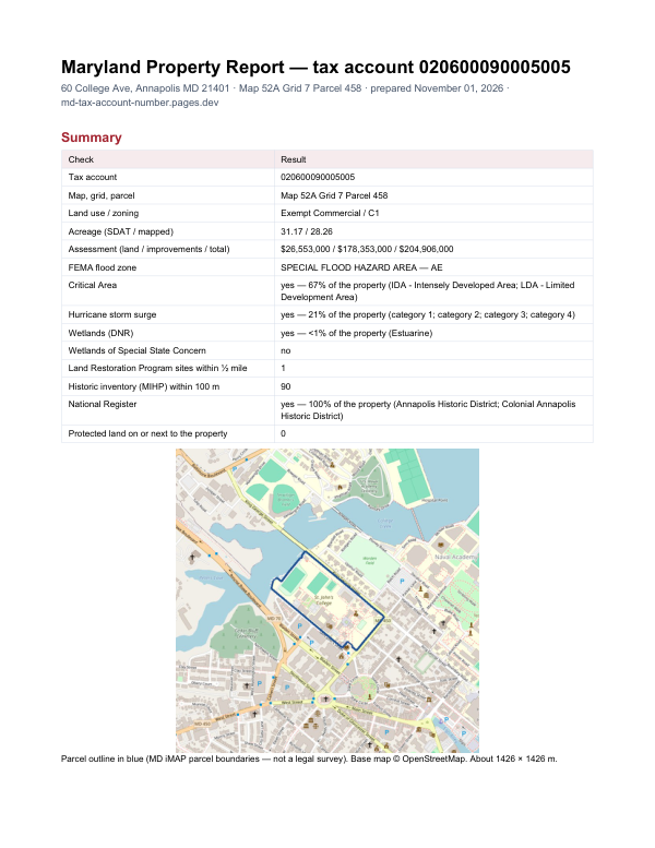
Before you buy in Anne Arundel County
The report adds what lies around one property: FEMA flood zone, Critical Area, wetlands, contaminated land sites nearby and historic properties.
$19card · PDF within 24 h · you pay after receiving itSee the sample (PDF)