17401 Bowie Mill Rd, Derwood — tax account 160801497521
Single-family house built in 1972, 3,386 ft² on 2.06 acres in Derwood, Montgomery County, assessed at $935,200; last transfer October 1, 2025 for $945,500.
From the State Department of Assessments and Taxation file as published by the Maryland Department of Planning (MD iMAP) — not the official record. Open the official SDAT record.
Account
| Tax account number | 160801497521 |
|---|
| Map, grid, parcel | Map GT56 · Lot 1 |
|---|
| Location | 17401 Bowie Mill Rd, Derwood MD 20855 |
|---|
| Jurisdiction | Montgomery County |
|---|
| Subdivision | Olney Outside Residences 2 |
|---|
| Plat | 10082 |
|---|
Land
| Land use | Residential (R) |
|---|
| Zoning | RE1 |
|---|
| Acreage | 2.060 acres (89,734 ft²) |
|---|
Structure
| Year built | 1972 |
|---|
| Above-grade area | 3,386 ft² |
|---|
| Style | 2 Story With Basement |
|---|
| Building type | Standard Unit |
|---|
| Construction | Brick |
|---|
| Quality grade | 5 (on a scale of 1 to 9) |
|---|
Assessment — January 2026
| Land | $374,300 |
|---|
| Improvements | $560,900 |
|---|
| Total | $935,200 |
|---|
| Homestead qualification code | 1 |
|---|
Last transfer
| Date | October 1, 2025 |
|---|
| Consideration | $945,500 |
|---|
| Deed reference | liber 55884, folio 0341 |
|---|
What this means
- Maryland reassesses each property every three years; increases are phased in over the following three years, and the Homestead Tax Credit caps the yearly increase on a principal residence.
- Assessed 50% above the median residential account in Montgomery County ($623,400, 248,486 accounts).
- The last transfer price is 1% above the current assessment.
- Built before 1978: Maryland requires rental units built before 1978 to be registered with MDE and to pass a lead-risk reduction inspection.
Parcel point of the Maryland Department of Planning — not a survey.
Data: Maryland Department of Planning / SDAT, MD iMAP Parcel Points, retrieved November 1, 2026. Sources and freshness. No owner names or mailing addresses are published.
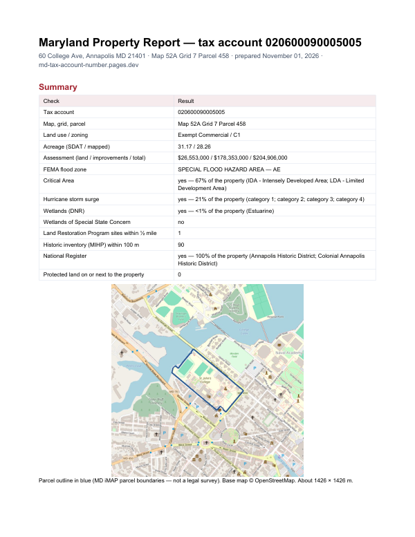
The report for account 160801497521
This page shows the assessment record. The report adds what lies around the property: FEMA flood zone, Critical Area designation, wetlands, contaminated land sites nearby and historic properties.
$19card · PDF within 24 h · you pay after receiving itSee the sample (PDF)
Order the report