428 Crain Hwy N, Glen Burnie — tax account 020532606050910
Commercial built in 2000, 3,574 ft² on 0.31 acres in Glen Burnie, Anne Arundel County, assessed at $856,900; last transfer May 6, 2026 for $530,000.
From the State Department of Assessments and Taxation file as published by the Maryland Department of Planning (MD iMAP) — not the official record. Open the official SDAT record.
Account
| Tax account number | 020532606050910 |
|---|
| Map, grid, parcel | Map 9F Grid 6 Parcel 496 · Lot 1R |
|---|
| Location | 428 Crain Hwy N, Glen Burnie MD 21061 |
|---|
| Jurisdiction | Anne Arundel County |
|---|
| Subdivision | Glen Burnie |
|---|
Land
| Land use | Commercial (C) |
|---|
| Zoning | C3 |
|---|
| Acreage | 0.310 acres (13,504 ft²) |
|---|
Structure
| Year built | 2000 |
|---|
| Above-grade area | 3,574 ft² |
|---|
| Style | OFFICE Office Building |
|---|
| Building type | OFFICE Office Building |
|---|
| Quality grade | 3 (on a scale of 1 to 9) |
|---|
| Stories | 1 |
|---|
Assessment — January 2026
| Land | $398,800 |
|---|
| Improvements | $458,100 |
|---|
| Total | $856,900 |
|---|
Last transfer
| Date | May 6, 2026 |
|---|
| Consideration | $530,000 |
|---|
| Deed reference | liber 09528, folio 0221 |
|---|
What this means
- Maryland reassesses each property every three years; increases are phased in over the following three years, and the Homestead Tax Credit caps the yearly increase on a principal residence.
- Assessed close to the median commercial account in Anne Arundel County ($865,600, 5,303 accounts).
- The last transfer price is 38% below the current assessment.
Parcel point of the Maryland Department of Planning — not a survey.
Data: Maryland Department of Planning / SDAT, MD iMAP Parcel Points, retrieved November 1, 2026. Sources and freshness. No owner names or mailing addresses are published.
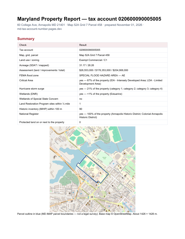
The report for account 020532606050910
This page shows the assessment record. The report adds what lies around the property: FEMA flood zone, Critical Area designation, wetlands, contaminated land sites nearby and historic properties.
$19card · PDF within 24 h · you pay after receiving itSee the sample (PDF)
Order the report